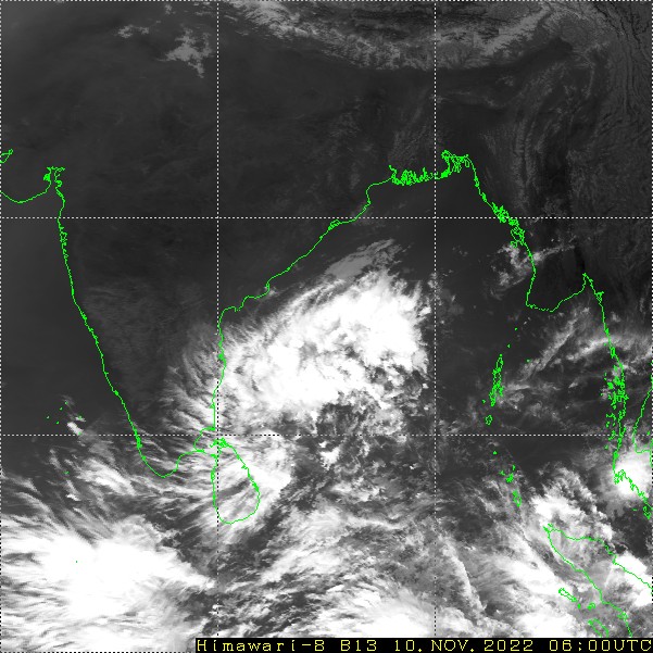
Under the influence of cyclonic circulation over Southwest Bay of Bengal (BoB), low pressure area formed yesterday. It has gained strength and the cyclonic circulation is now extending up to higher levels in the atmosphere. The weather system has moved northwest to come closer over the Southwest BoB and Sri Lanka coast. Apparently, the low pressure has become well marked as propounded by satellite imagery.
The central portion of the low pressure still remains about 300km away from the coast. Peripheral of the system will reach in the close proximity of Central and Northern coast of Tamil Nadu and Gulf of Mannar, tomorrow. On 12th Nov, it will move across South Peninsula, through interior parts of Tamil Nadu and Kerala. Subsequently, the weakened low will enter the Arabian Sea on 13th Nov and drift further away later on.
Heavy to very heavy rains are expected over Tamil Nadu, including the capital city Chennai and South Coastal Andhra Pradesh. Moderate showers are likely over southern parts of Rayalaseema, covering Tirupati, Chittoor and Cuddapah with isolated heavy rains at few places.
Southern parts of South Interior Karnataka and border areas of Kerala with Tamil Nadu are likely to have moderate to heavy rain and thundershowers. Bengaluru, Mysore, Mandya, Chamrajnagar, Wayanad, Palakkad, Malappuram, Munnar and Idukki will be at risk of heavy sharp showers on 11th and 12th Nov. Light to moderate rain and showers will continue over this region till 15th Nov and general clearance is likely on 16th Nov and later.


