Monsoon System Forms Over Bay Of Bengal: Heavy Rainfall Likely

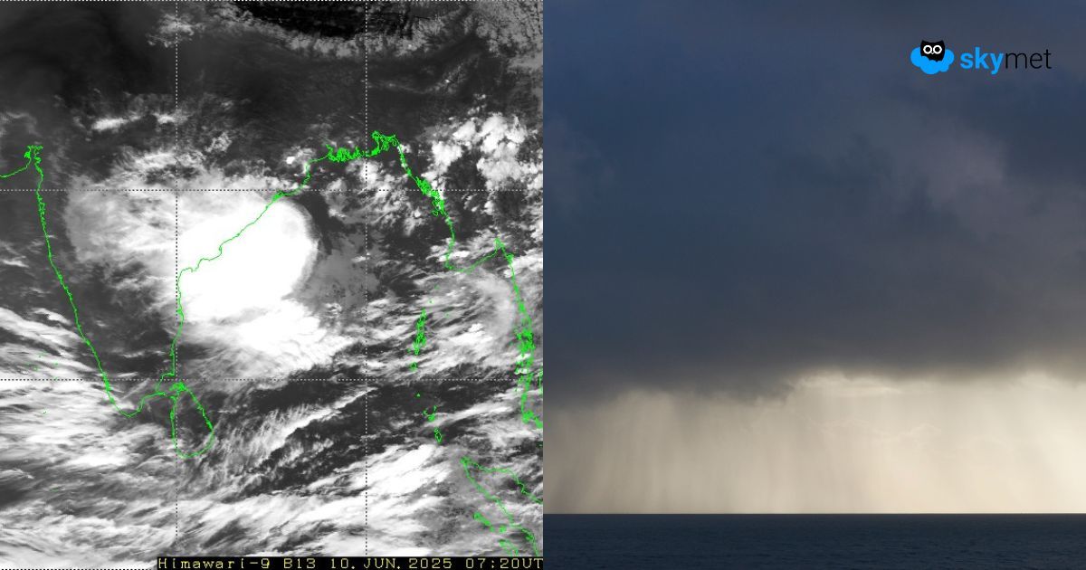
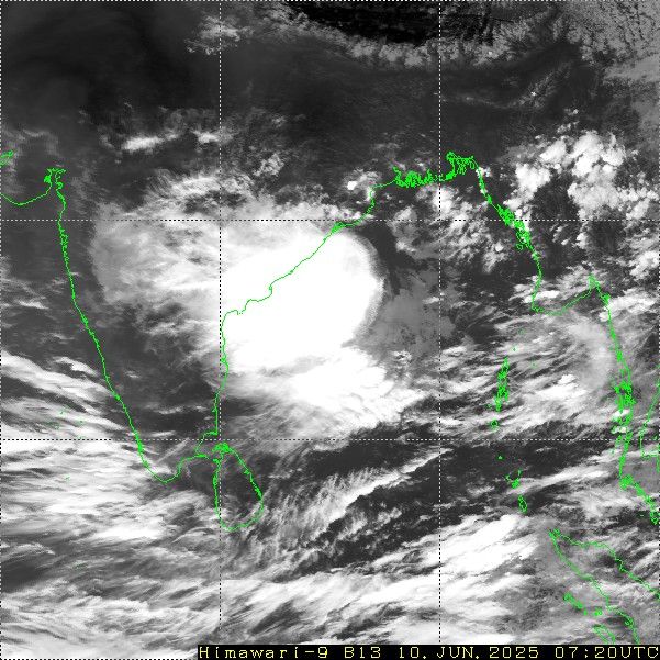
On the predicted lines, a cyclonic circulation has formed over the Bay of Bengal (BoB), off South Odisha and North Coastal Andhra Pradesh. A significant cluster of clouds associated with the system is covering large areas on either side of the coastline. Due to the proximity of land, this weather system may not strengthen further and will move inland as a cyclonic circulation itself.
The peripherals of the system will have light to moderate showers over Coastal Andhra Pradesh and South Coastal Odisha today.
The circulation will shift completely over land a day later, on 12th June. The extent of heavy rainfall will become broader to cover South Coastal Andhra Pradesh, Rayalaseema, North Interior, and Coastal Karnataka. The borderline of the system will breach parts of Maharashtra, but remain confined to South Madhya Maharashtra and the South Konkan region. Thereafter, heavy rains will vacate the interiors of the South Peninsula and affect the coastal parts. Heavy to very heavy rainfall is expected over Kerala, Coastal Karnataka, and Konkan & Goa between 13th and 16th June, albeit in a staggered manner.
Mumbai is likely to have the first heavy downpour of June during this period. While this system weakens, another monsoon circulation is likely to come up on 14th June over Northwest BoB. The weather activity will start again from the eastern coast and travel across Odisha, Chhattisgarh, Maharashtra, and Madhya Pradesh. This wet spell will bring the monsoon stream closer to the northern plains as well.