Above average sea surface temperature (SST) continued across most of the equatorial Pacific Ocean. However, SST anomalies have weakened in the eastern and central Pacific, as is evident from the weekly Nino index values, exception being Nino 3.4. Although, above average temperatures persisted in the upper 100 mtrs of the equatorial Pacific, changes were more pronounced below this level, where the anomalies have turned nearly zero or even marginally negative between 180°-120°W. This covers Nino 3.4 region. Atmospheric anomalies appear to be biased without any conclusive evidence. Collectively, the coupled ocean-atmosphere system reflected weakening El Nino.
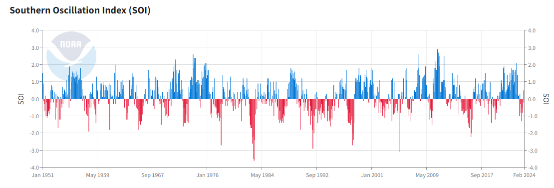
ENSO: A super El Nino is known for triggering strong La Nina in the following year. Dilution of El Nino conditions to neutral first and quickly transforming to La Nina is always an intriguing story generating heated discussions on the subject issue and its likely outcome. Inconspicuous behavior of the Southern Oscillation Index does not align with the typical fall of El Nino towards neutral. Fluctuations of SOI are rather large and nearly inexplicable. Possibly, such aberrations are attributable to increase in the ‘noise’ of oceanic conditions during ‘spring barrier’.

After having gradual dip over the last 5 weeks, Nino 3.4 has shown a marginal rise. Last week, SOI had abruptly shot up to -1.4, its highest average value for the month of February 2024. The continuing support from the atmospheric arm of ENSO, evidently suggested slow down of cooling in the Oceanic Nino Index (ONI) region. However, these changes need to be carefully watched and validated for sustenance.
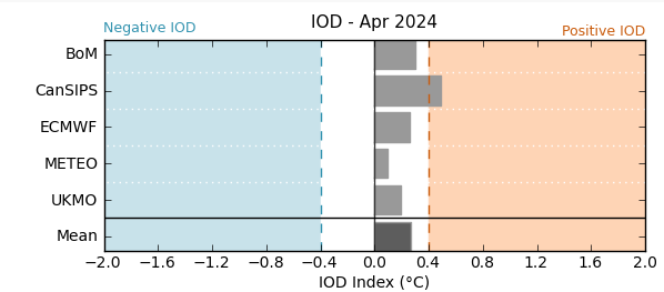
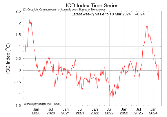
IOD: Like the seesawing of Nino 3.4 index, Indian Ocean Dipole also remains divergent. It has unexpectedly turned positive neutral from its last week stance of negative neutral. The Indian Ocean Dipole is currently neutral with the IOD index being +0.24°C, for the week ending 10March 2024. IOD values are likely to remain neutral until, at least April. As such, typically, the event starts building up after April and stabilizes during the monsoon season.
MJO: The Madden-Julian Oscillation was quite strong last week, when it propagated from the Indian Ocean to the Maritime Continent. During the next one week, the MJO will move to the West Pacific (Phase 6) with a consistent speed and strong amplitude. Subsequently, it is likely to sail over Western Hemisphere and Africa (Phase 8) with marginalized amplitude. While over the Pacific, its interaction with the ENSO signal will be interesting to watch. It may add volatility to the Nino indices, more so, the Oceanic Nino Index, Nino 3.4.

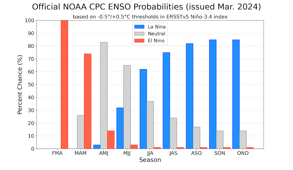
Better prospects of southwest monsoon, envisaged on account of La Nina, does not come without a rider. Corollary is not as simple as it may appear. Plus, we don’t have a clear signal, as yet. Pacific conditions alone can not be considered decisive. Skymet always advocate, that other global parameters impacting the health of the monsoon will have to be factored in, for a judicious call on monsoon.