
The trough of low at mean sea level lies over Southwest Bay of Bengal off Tamil Nadu Coast. This system is extending from Equatorial ocean to Tamil Nadu Coast and moving in west/northwest direction.
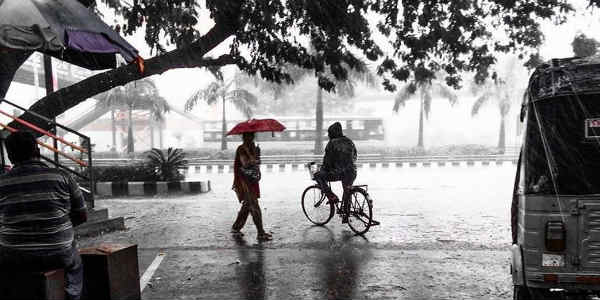
In wake of the above-mentioned weather system, during he last 24 hours, many places of Tamil Nadu observed light to moderate rain and thundershower activity.
In the last 24 hours from 08:30 am on Saturday, Pamban recorded 27 mm of rain, followed by Parangipettai 23 mm, Chennai 22 mm, Cuddalore 16 mm, Nagapattinam 12 mm, Thondi 8 mm and Tuticorin 6 mm.
Moreover, during the next 12 to 18 hours, spell of rain and thundershower will continue to effect over many places of Tamil Nadu. In fact, Chennai will also observe light to moderate rainfall activity.
Further, as the above system would be moving west/northwestwards, rainfall activity will start decreasing from northeastern parts of Tamil Nadu. Rains will restrict to the southern and eastern parts of the state after 24 hours.
Due to the ongoing rains, both day and temperatures are expected to decrease over most parts of Tamil Nadu. Even the clouds and humidity will remain at higher levels.
However, after 24 hours, day temperatures will start increasing over North Tamil Nadu. Meanwhile, gradually decrease in night temperatures will also be observed.
Places such as Nagapattinam, Karaikal, Rameswaram, Pamban, Ooty, Coonoor and Kodaikanal are likely to witness good sell of rain and thundershower during the next 24 to 36 hours.
Image Credits – Wikipedia
Please Note: Any information picked from here must be attributed to skymetweather.com
