
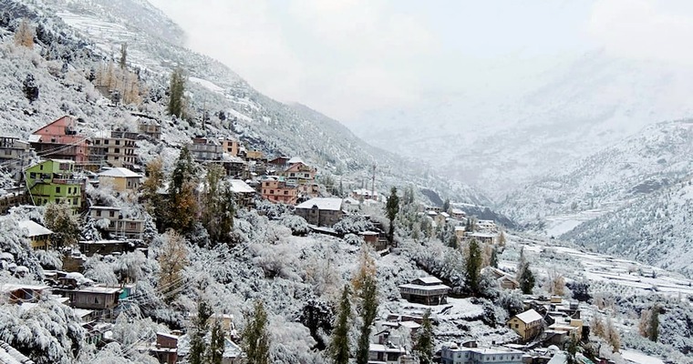
Hilly states of North India have snowed heavily for three days in a row, between 18th and 20th Feb 2024. Weather activity had been relatively weak in the past 24 hours. The remnant effect of the system will continue today but is limited in intensity and spread over the entire range of mountains. Tomorrow, the conditions are expected to improve substantially and there could only be freak occurrence in the higher reaches of the mountains.
The last spell of snow and rain has rescued the hilly states, staring earlier at a possible winter drought. Seasonal rainfall/ snowfall deficiency of about 70 % around the middle of February has now recovered to under 40% shortfall for the states of Jammu & Kashmir and Himachal Pradesh. The Farther state of Uttrakhand still has a deficit of about 46%. This state may not have any measurable activity in the remaining days of the month but could catch up later.
After the remnant weather activity in pockets of mid and higher reaches today, 23rd Feb will be a ‘break’ day for the mountains. However, another western disturbance will approach the Western Himalayas on 24th Feb and the activity will resume, albeit for the mid and high-elevated regions of the states. Scattered rain and snow, limited to a few areas, is likely on 24th and 25th Feb. This western disturbance will get another push from a passing trough, which will enhance the activity level on 26th and 27th Feb. Even the lower hills like Srinagar, Patnitop, Dalhousie, Manali and Dharamshala can expect rain and snow during this period.
The next breather will be very short and sweet, on 28th Feb. As another weather system, waiting in the wings arrives on 29th Feb, weather activity will get a fresh lease for the next 3 days. Light to moderate rain and snowfall is likely on 29th Feb. However, the intensity and spread will build up in the subsequent 48 hours, at the start of March. Another round of peak weather activity can not be ruled out, both, for the plains and hills, simultaneously.
It also means that wintry touch and flavour are not going to end, too soon. Since the seasonal weather activity of rain and snow commenced rather late this season, it is likely to get prolonged. A portion of this may get spilt over to the spring season, which otherwise gives a knock anytime from the start of March.
Image Credit: business-standard
