
Southwest Monsoon will retreat completely from the country in the next few days. Onset of northeast monsoon is scheduled around 20thOctober. Post monsoon season tentatively begins after first half of October. October to December marks the prime stormy season for the Indian Seas, both, Bay of Bengal and Arabian Sea. Pre monsoon season from March to May is slightly reluctant as compared to post monsoon for storms. Notwithstanding, two cyclonic storms have already formed this year, both extremely severe cyclonic storms, one each in the Bay of Bengal (Mocha) and Arabian Sea (Biparjoy).
Indian seas have an average frequency of 4-5 tropical storms in a year. Bay of Bengal has a share of 60% and the rest 40% originate over the Arabian Sea. Last year, 2 cyclonic storms formed during post monsoon season, both over Bay of Bengal. Tropical storm Sitrang had life cycle of 5 days, from 22 Oct to 25 October 2023. The other tropical storm Mandous had similar life span from 06th Dec to 10th Dec 2023. Cyclonic storm Sitrang made landfall in Bangladesh. Severe Cyclonic Storm Mandous headed for Tamil Nadu coast. It weakened over the sea itself and crossed coast near Chennai as deep depression.
Both the storms of this year weakened a shade, before making landfall. Extremely Severe Cyclonic Storm (ESCS) Mocha struck Myanmar, near Sittwe on 14thMay 2023. The other ESCS Biparjoy over the Arabian Sea headed for Gujarat coast and made landfall on 16thJune, near Naliya- Kutch. This cyclone had a long sea travel crossing abeam Coastal Karnataka, Goa, Konkan, South Gujarat between 06th-15th June 2023.
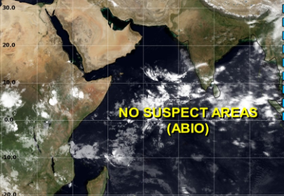
Conditions are building up over the southeastern parts of the Arabian Sea, next to the equatorial region. Warm Indian Ocean on account of positive IOD and marginally favoured MJO, together may pop up a cyclonic disturbance shortly. It is rather pre-mature to commit anything, other than a cyclonic circulation over the Southeast Arabian Sea around 15thOctober. This may shift over extreme South-Central parts of the ocean in the subsequent 72 hours and may shape up as low pressure area. Very low latitude and unfavourable environmental conditions do not suggest any fast pick up.
There is no ‘suspect area’ at present over the Arabian Sea. But, such perturbations need to be closely observed for any sudden intensification. These weather systems start growing only after crossing a latitude of 10°N. These sea-born disturbances have a very small chance of changing track, pointing towards the Indian coastline. Even when these systems become significantly strong, climatological records suggest sea travel towards Somalia, the Gulf of Aden, Socotra Islands, Yemen and Oman.
