
The Depression which had been causing hefty rains over eastern parts of Indonesia has now turned into a Tropical cyclone named as Lili.
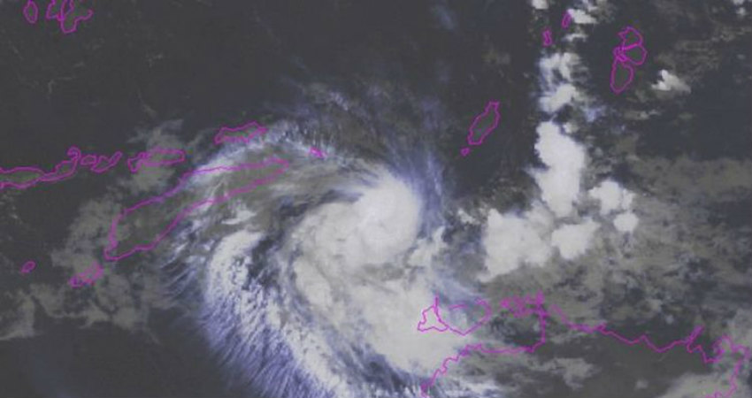
Cyclone Lili at 8:30 in the morning hours was near Latitude 9.9 degrees South and Longitude 129.1 degrees East. The system is located around 189 nautical miles northwest of Darwin, Australia and is moving in a south-southwest direction around 10kmph during the last six hours.
Lili will recurve towards the west in next six hours and will continue westwards journey until tomorrow morning when it will make a landfall in and around Timor. The system is moving in a favorable environment, with low vertical wind shear, and sea surface temperatures are also high.
However, now soon dry air will start entering and upper level convergence is expected to hinder further development and it would weaken. At present, the wind speed is around 80-90 kmph and would continue with same intensity at the time of landfall as well, gusting up to 90-100 kmph.
Cyclone Lili will shift to the south as well as west during the next two days and is likely to weaken and become insignificant before affecting Western Australia.
However, heavy rain is expected and the possibility of flooding over the island of Timor in the coming days cannot be ruled out. However, winds will not be strong enough to damage anything else.
Areas to be impacted will include Alor, Belu, Ende, Flores Timur, Kupang, Manggarai, Ngada, Sikka, West Sumba, East Sumba, Timor Tengah Selatan, Timor Tengah Utara of the southern island of Indonesia.
Image Credit:
