

Low-Pressure Area Forms Over BOB: Heavy Rains Over Eastern Parts

Key Takeaways:
- A low-pressure area over the North Bay is expected to move northwestward and enhance monsoon activity across eastern India.
- Heavy rainfall will initially remain concentrated over North Odisha, Gangetic West Bengal, Jharkhand and adjoining North Chhattisgarh.
- Rainfall will spread across Bihar, East Uttar Pradesh and East Madhya Pradesh between August 14 and 16.
- Break-monsoon conditions may emerge from August 17, shifting the heavy rainfall belt towards the Himalayan foothills while western and central India witness subdued activity.
- Forecast Validity: Next 3 to 5 days.
Advertisement
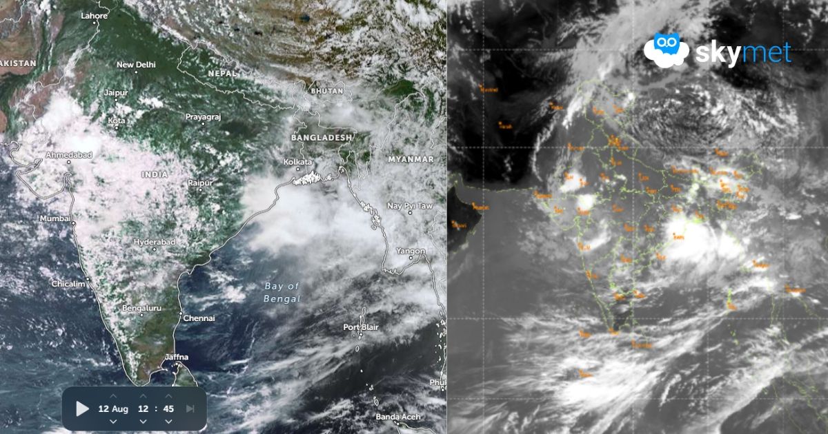
Under the influence of a cyclonic circulation over the Bay of Bengal, a low-pressure area has formed over the North Bay and adjoining coastal parts of Gangetic West Bengal and Bangladesh. The low pressure will become more marked and move northwestward across West Bengal, North Odisha, Bihar, Jharkhand and East Uttar Pradesh. Active monsoon conditions with heavy rainfall are likely over these states during this week and may even roll over to the next week to cover some more parts.
Advertisement
The formation of the system and its further track are a little unusual and completely different from the previous low-pressure area, the remnants of which are lying over West Madhya Pradesh and East Rajasthan. This low pressure is unlikely to visit those parts and will restrict the weather activity to the eastern states and foothills of the Indo-Gangetic Plains. There lies an outside chance that the track of this system may lead to a pattern like ‘break-in-monsoon’, albeit temporarily.
To start with, heavy rainfall will be confined to North Odisha, Gangetic West Bengal and border areas of North Chhattisgarh and Jharkhand for the next two days. The spread of rainfall will increase and cover Bihar, East Uttar Pradesh and East Madhya Pradesh between 14th and 16th August. The influence of the monsoon trough will extend this activity to the entire stretch of the Indo-Gangetic Plains also, during this period. The weather system is unlikely to pick up strength and will have a tendency to move more northward, closer to the foothills of Bihar and East Uttar Pradesh.
The break monsoon conditions are likely from 17th Aug onwards, wherein the heavy rainfall belt will stretch all along the foothills from Uttarakhand-West Uttar Pradesh to Sikkim-Sub-Himalayan West Bengal. Moderate to heavy showers will reach many parts of the plains in Bihar and Uttar Pradesh as well. Most other parts of the country, more so the western and central parts, will have minimal weather activity during this period.
The month of August, as such, is more vulnerable to monsoon breaks. The duration of a break can go on from a few days to over a week. The normal monsoon pattern resumes with a fresh weather system coming up over the North Bay of Bengal. As of now, there are no precursors, and more information will emerge around the start of next week.
Trending:



