

Low Pressure Area Over West Bengal, Odisha, Jharkhand: Heavy Rains Over Eastern-Central Parts

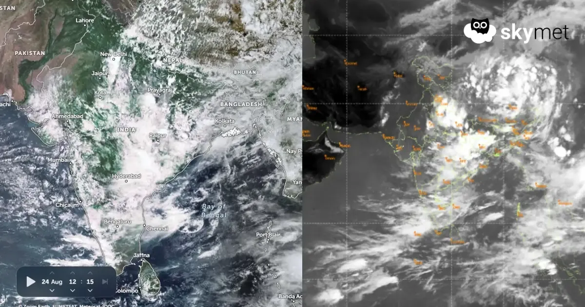
Key Takeaways:
- The Northwest Bay low-pressure area has moved largely over land across parts of West Bengal, North Odisha and Jharkhand.
- Fairly widespread rain and thundershowers are expected over Odisha, Chhattisgarh and East Madhya Pradesh over the next two days.
- Intense weather will start vacating Rajasthan on August 26 and Madhya Pradesh by August 27 before shifting eastward.
- Kerala, Coastal Karnataka and Goa will continue to witness active monsoon conditions with isolated heavy showers this week.
- Forecast Validity: Next 2 to 3 days.
Advertisement
The low-pressure area over the Northwest Bay of Bengal has moved northwestward and now lies more over land than the sea. The low-pressure area is covering parts of West Bengal, North Odisha and Jharkhand. The cyclonic circulation is extending beyond 20,000 feet in height. The system will move further northwest and get placed over northern parts of Jharkhand and North Chhattisgarh. It may not travel further deep over land and may rather get retarded over Bihar, Jharkhand and West Bengal around mid-week.
Advertisement

There are multiple weather systems aiding the low-pressure area in enhancing the spread and scale of weather activity. The eastern end of the monsoon trough is embedded along the axis of the cyclonic circulation. Also, there is an east-west oriented shear zone almost along 22°N, aligned with the convergence zone of the low-pressure area, a little ahead of the centre of circulation. All these factors are acting in tandem to sustain and reinforce the weather activity over the eastern parts and stretch it further to the central parts of the country.
The extent and reach of weather activity will be greater between 24th and 26th August 2026, before it starts shrinking in space and intensity. Over the next two days, fairly widespread rain and thundershowers are expected over Odisha, Chhattisgarh, East Madhya Pradesh and the peripheral parts of Jharkhand and Uttar Pradesh. The heavy weather with stormy conditions will reach as far as parts of West Madhya Pradesh and contiguous parts of Rajasthan.
The intense weather activity will start vacating Rajasthan on 26th August and the entire Madhya Pradesh region by 27th August 2026. Vigorous weather conditions will then shift east and enclose most parts of Bihar, Jharkhand, North Chhattisgarh, North Odisha and Gangetic West Bengal. Eastern parts of Uttar Pradesh, sharing a boundary with West Bihar, will also get spillover thunderstorms and showers.
The western, central and southern parts of the country will have the least weather activity after 26th August and are unlikely to witness a revival during the remaining days of the month. Kerala, Coastal Karnataka and Goa will have active monsoon conditions with isolated heavy showers during this week.



