
The off-shore Trough is likely to extend further towards South, that is from Gujarat to Kerala. This system will be associated with the surge over North Konkan. During this time, heavy to very heavy rains will be seen over North Konkan including South coastal Gujarat and Madhya Maharashtra. Places like Mumbai, Nashik, Pune, Aurangabad, Ahmednagar may be impacted by these heavy to very heavy spells.
Heavy spells are also very likely over South Konkan like Satara, Kolhapur and Goa. Rainfall activity is likely to reduce over rest parts of Maharashtra. However, moderate spells will continue over the region. Most parts of Madhya Pradesh and East Gujarat will receive moderate spells and light spells can be seen over Chhattisgarh and rest Gujarat.
While, in the eastern part of the country, a Cyclonic Circulation has formed over the Northeast Bay of Bengal and adjoining West Bengal. The axis of Monsoon Trough is moving across South Jharkhand, Gangetic West Bengal and then to Northeast Bay of Bengal. A Low-level Circulation lies over East Assam and adjoining Arunachal Pradesh. Hence, scattered light to moderate activities are expected over Bihar, West Bengal and Jharkhand. Midnapore, Purulia, Malda in West Bengal, Dhanbad and Deogarh in Jharkhand and Patna, Gaya, Bhagalpur in Bihar will see light to moderate rains. Meanwhile, mainly light rains will be seen in Odisha.
Scattered light to moderate rains will continue over most parts of Northeast India and Sikkim. Kolkata will see light to moderate rain and thundershowers which will be patchy in nature. The activity is likely to enhance in Kolkata after 24 hours.
Up in the North, the Trough has shifted slightly to North and is presently moving across Punjab, Haryana, North Madhya Pradesh and South Uttar Pradesh. In wake of this, the rain activity is likely to enhance over most parts of Uttar Pradesh and South Haryana.
As per the experts, light to moderate rains are expected mainly over Gorakhpur, Faizabad, Bareilly, Saharanpur, Pilibhit, and Agra, with patchy rains in parts of foothills of Punjab and Haryana. Rupnagar, Chandigarh, Panchkula, Patiala, and Ambala might see patchy Monsoon showers including Delhi.
Click the image below to see the live lightning and thunderstorm across India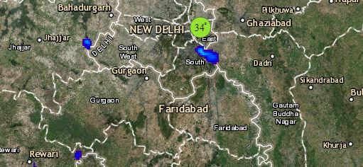
East Rajasthan to see moderate rains at many places and light rains will be elsewhere except extreme West Rajasthan.
Meanwhile, moderate showers are possible over southern parts of Himachal Pradesh and Uttarakhand wherein chances of landslides are very likely. The southern districts of Jammu and Kashmir will see light rains.
Finally, down South, as the off shore trough has shifted toward South, rainfall activity will now enhance over Kerala; coastal stations may receive moderate spells at many places. While Karnataka coast will receive moderate to heavy rains. Honnavar, Karwar, Mangaluru and Agumbe will see such type of rainfall activity. Kozhikode, Kannur and Kochi will see moderate spells.
Whereas, the interior parts of Karnataka will see mainly light rains with isolated moderate spells.
Rains are now likely to reduce over Telangana as the Trough which was moving across North of Telangana will merge with the Cyclonic Circulation over the North Bay of Bengal.
Subdued Monsoon activities will be seen over Tamil Nadu and Rayalaseema.
Any information taken from here should be credited to skymetweather.com
