
Dismembering Indian Ocean Dipole ( IOD) and pervasive El Nino have modified the differentials and resultant interaction, between the two most powerful oceanic parameters. While the El Nino conditions in the central-eastern equatorial Pacific remain strong, the IOD is weakening steadily. The ongoing constructive interface is likely to get diluted. The enhanced trades over the equatorial Indian Ocean associated with the positive IOD are favoured to relax. This will have a strong bearing on the shift of monsoon trough to the Southern Hemisphere and impact weather conditions of Australia and Oceania continents.
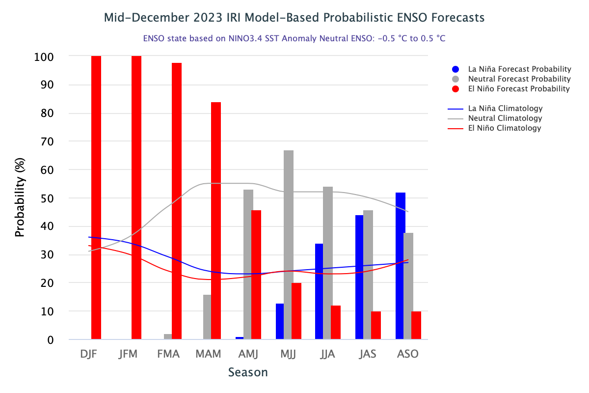
ENSO: Key oceanic and atmospheric variables are consistent with ongoing El Nino event. Weather based models depict continuation of El Nino till boreal spring 2024 and rapidly weaken thereafter, to turn ENSO neutral. It is likely to remain so during the rest of the forecast period.
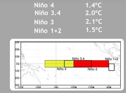
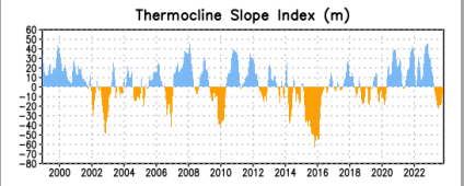
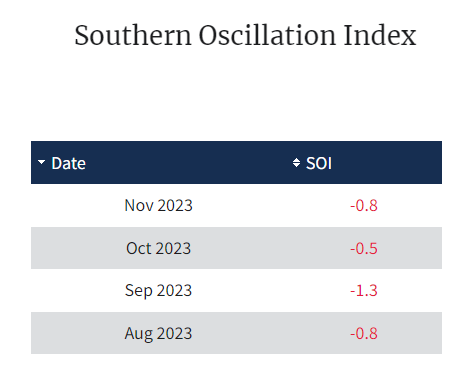
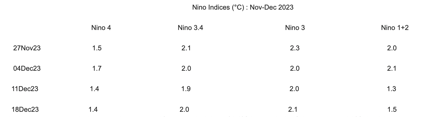
All the Nino indices are stable in the respective regions. After a marginal drop of 0.1°C last week, the ONI is back to + 2.0°C. It still has the potential to rise further, before receding during late winters or early spring of Northern Hemisphere. Southern Oscillation Index (SOI) remain in a stern mode and extend assuring support for sustenance of El Nino. Upper ocean heat content and thermocline index in the equatorial Pacific reflect moderate to strong El Nino.
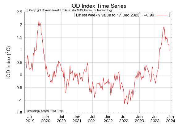
IOD: A positive Indian Ocean Dipole event remains active, albeit getting diluted. The latest index value for the week ending 17 Dec 2023 was 0.98°C, a drop of over 0.2°C from the last week. A complete break down of such a strong event will linger on for sometime.
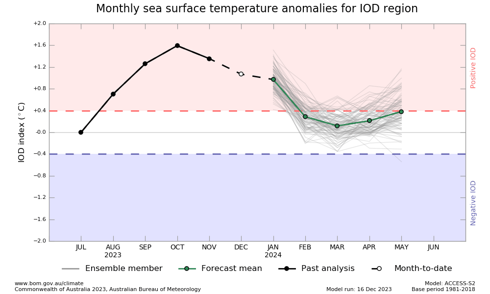
Though, positive IOD is likely to continue and ease over the coming weeks, but the index is likely to fall below the threshold of +0.4°C, only in late January 2024. Flattening of IOD is influencing Australian weather. Storm frequency is likely to increase. Last week, storm Jasper ravaged northeast Australia with the biggest floods of the century and over 300 people got rescued in Queensland.
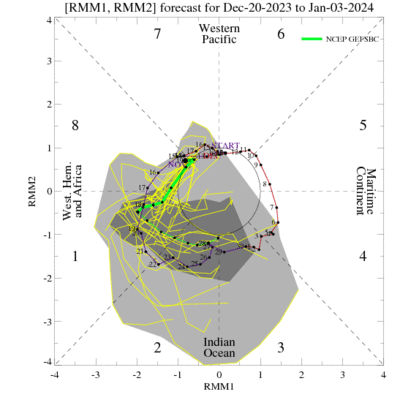
MJO: Madden-Julian Oscillation has moved from the Western Pacific to the Western Hemisphere and Africa in Phases 8 & 1. It is likely to spend about a week with low amplitude. It is expected to return to the Indian Ocean at the fag end of December and early 2024. There is a fair amount of uncertainty regarding its strength over that region. However, no uptick is likely in the convective activity over the Indian Seas during the remaining days of December and the start of January. The ongoing interference between the MJO and El Nino may remain inconsequential, with hardly any potential for reviving the northeast monsoon. The seasonal monsoon may end on a soft note.
With submissive MJO and diminishing IOD, the northeast monsoon may stay in a dormant state over the Bay of Bengal. The Arabian Sea may witness cyclogenesis towards the fag end of the month. As such, the monsoon commences withdrawal from the South Peninsula and North Andaman Sea, around this time of the year. It is time for Sri Lanka to witness active phase of ‘Maha’ monsoon for the next 4-5 weeks.
