

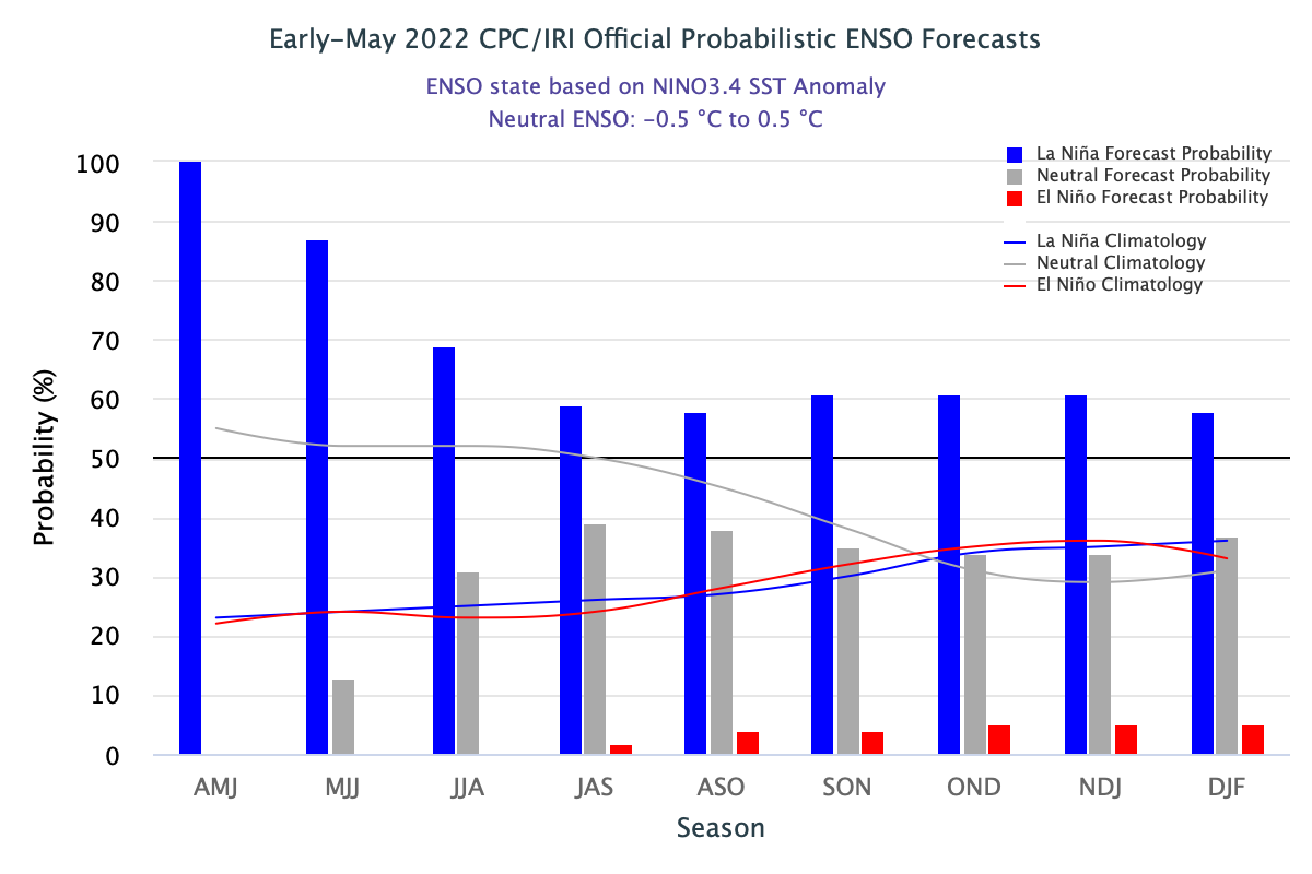
Sea Surface Temperatures (SST) in the Pacific Ocean are below average across most of the equatorial belt. Cooling of the sea surface is maintained or rather increased its strength over the last fortnight. Accordingly, the Tropical Pacific atmosphere is consistent with La Nina. However, sub-surface waters of the Tropical Pacific have warmed up slightly close to the neutral ENSO levels. La Nina is favored to continue through the Northern Hemispheric summer with about a 60% chance during June-August 2022. Weak La Nina conditions may even prevail with a 50-55% chance through the fall of the year.
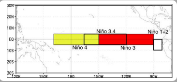
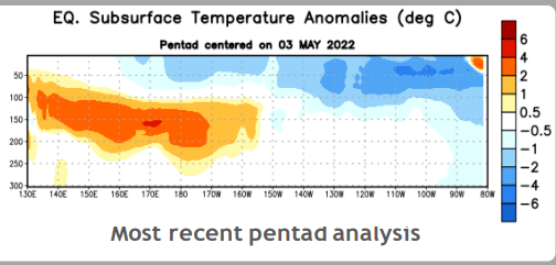
ENSO: Nino 3.4 region of the Equatorial Pacific Ocean spans between 5°N -5°S / 120°W - 170°W and the Nino 4 region is bound between 5°N -5°S / 150°W – 180 - 160°E. The rise of temperature beneath the surface of the Tropical Pacific can be appreciated in the picture. This warming may further extend to Nino3 (5°N -5°S / 90°W -150°W) and Nino1+2 ( 0°- 10°S / 80°W - 90°W).
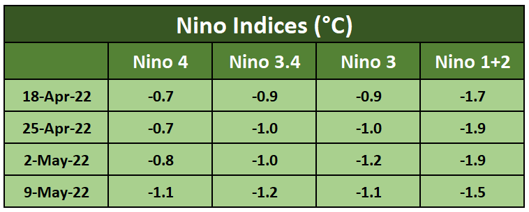
The Oceanic Nino Index (ONI) is based on Sea Surface Temperature departures from average in the Nino 3.4 region and is the principal measure for monitoring, assessing, and predicting ENSO.
IOD: The Indian Ocean Dipole is currently neutral. The intensity of IOD is represented by an anomalous SST gradient between the Western Equatorial Indian Ocean (50°E-70°E/ 10°N-10°S) and Southeastern Equatorial Indian Ocean (90°E-110°E / 10°N-10°S).
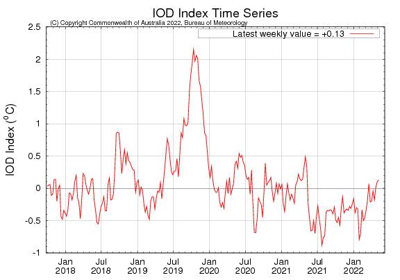
The latest IOD index value for the week ending 08 May 2022 was +0.13°C. For the last 3 consecutive week, IOD is retaining +ve status ( +0.01°C, +0.10°C , +0.13°C). Surface waters are warmer than average over most of the Indian Ocean for the week ending 08th May. The majority of numerical models indicate a -ve IOD event could develop early in the monsoon season. However, the 2nd half of the season remains at a bigger risk. Model projections at this point of time for the latter half of the season are marred with low accuracy and so be considered with caution. While a +ve IOD can absorb the ill effects of El Nino, -ve IOD may neutralize partially the good bursts of La Nina conditions.
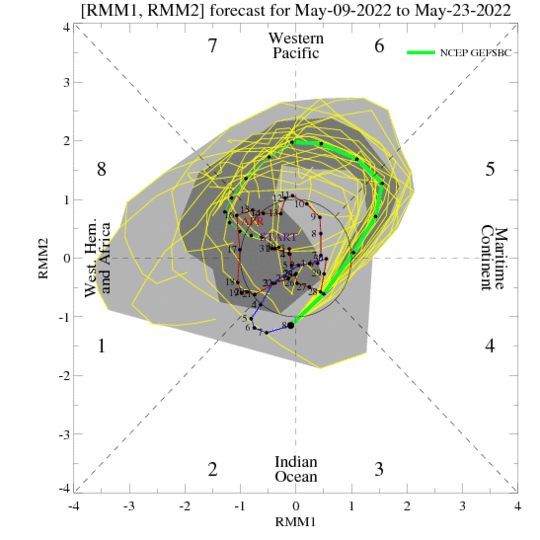
MJO: Unlike a standing pattern like the ENSO, the MJO is a traveling pattern that propagates eastward at approximately 4-8m/s through the atmosphere above the warm parts of the Indian and Pacific Oceans. This overall circulation pattern manifests itself most clearly by anomalous rainfall. Madden Julian Oscillation has recently strengthened in the Maritime Continent phase. MJO is gradually shifting to Western Pacific and also dropping its amplitude, getting limited to the inner ring by 3rd week of May. Later, it is expected to come closer to the Indian Ocean around the normal onset date of the monsoon over Kerala.
The onset time of the southwest monsoon is nearing. Ocean parameters have a strong bearing and turn catalyst in building the surge. Anticipating all the 3 ocean-born indices: ENSO, IOD, and MJO getting aligned symmetrically, Skymet has predicted before time onset of monsoon. Southwest Monsoon is likely to reach the 1st post of Bay Islands and the Andaman Sea on 15th May. It is likely to make onset over Mainland Kerala on 26th May 2022, with a model error of +/- 3days.
