
Strengthening of cross equatorial flow is the foremost indication for impending onset of southwest monsoon over Indian region. Incursion of monsoon surge starts as early as 15thMay over South Bay of Bengal and South Andaman Sea. Normal date of advance for North Andaman Sea is 22nd May, Sri Lanka 26thMay and Mainland India on 01stJune. Although onset dates have been revised for most parts of the country, arrival over Kerala remains sacrosanct as 01stJune.
March, April and May comprise of pre monsoon cyclone season with growing probability for the Indian seas as the season advances. Last 2 years, 2020 and 2021 hosted a storm each in May on both sides of the coastline. Bay of Bengal (BoB) and Arabian Sea witnessed ‘Amphan’ (16-20May) and Nisarga ( 31May-04June) in 2020. In May 2021, Extremely Severe Cyclonic Storm ‘Tauktae’ struck Gujarat on 17thMay and Very Severe Cyclonic Storm ‘ Yaas’ made landfall in Odisha on 26thMay.
Timings of these cyclones in May and their track has a strong bearing in controlling the monsoon current. Any storm around 15thMay or later on either side of the coastline becomes consequential, both aspects inclusive, disruption of monsoon flow or facilitation of equatorial surge for early advance. Year 2020 and 2021 are the recent examples of cyclones steering the monsoon current in the respective basins. A powerful storm may trigger the cross equatorial flow and drag the monsoon surge over the area, earlier than expected. However, such a storm sucks out significant amount of moisture and therefore, could stall the further progress.
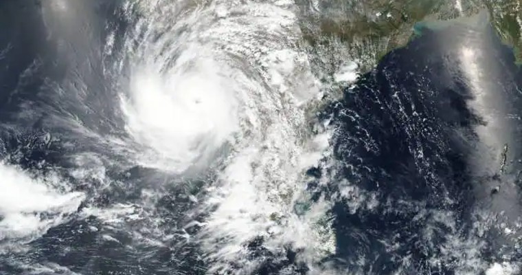
Amphan, a Super Cyclone, had explosively intensified from Cat-I equivalent hurricane to Cat-IV in just 6 hours. It made landfall at Bakkhali (West Bengal) in the afternoon hours on 20thMay 2020. Amphan left a trail of destruction and confirmed as costliest storm ever recorded in the basin. The super cyclone moved away quickly on 21stMay but not before depleting the BoB, gasping for moist air and heat energy. The advance of the monsoon was stalled over the Andaman Sea for almost 10 days after its arrival on 17thMay. Following this, a vortex formed over Southeast Arabian, speedily turning in to a low pressure area on 30thMay. This weather system intensified to become a Severe Cyclonic Storm Nisarga, landfalling coastal town of Alibag in Konkan on 03rdJune. The likely delay as earlier expected, was accelerated to strengthen the surge. Monsoon onset over Kerala was declared on 01stJune, against the previous expected date of 05thJune.
In 2021, Extremely Severe Cyclonic Storm ‘Tauktae’ formed in the Arabian Sea and moved parallel to the West Coast. This was the strongest tropical cyclone to make landfall in the Indian state of Gujarat since the 1998 Gujarat cyclone. Also, it was one of the strongest tropical cyclone to ever affect the West Coast of India impacting 7 states and union territories ( Lakshadweep, Kerala, Karnataka, Goa, Daman-Diu, Maharashtra and Gujarat). The storm tracked over the Arabian Sea between 14-19 May, striking Gujarat coast near Una on 17thMay night hours. The other cyclone ‘Yaas’ in the BoB spent 6 days over the sea, between 23-28 May. Very Severe Cyclonic Storm ‘Yaas’ made landfall on 26thMay, striking north of Dhamra port in Odisha. Both these storms had taken away the heat energy and therefore, lowered the Kinectic Energy of the water bodies. Consequent to the landfall of Yaas, weather activity was nearly ceased over Kerala for few days. Cyclone Yaas coincided with the timings of the monsoon arrival and delayed the onset.
Cyclones forming in the Arabian Sea around the onset time are mostly detrimental for the progress of the monsoon. Majority of these storms track away from the West Coast towards Somalia, Yemen and Oman and carry the monsoon surge along with. Contrary to this, the storms in the BoB mostly head for states of Odisha and West Bengal. This feature strengthens the eastern arm of the monsoon over BoB. Relatively, the western arm over the Arabian Sea mellows down to the extent of slowing advance along the West Coast.
Small size vortices forming on either side of the coastline are considered useful for strengthening cross equatorial flow and in turn the monsoon surge. Any powerful systems like tropical storms carry risk of disturbing the usual wind pattern and leave lot of lead time for restoration of normalcy. Monsoon onset under normal conditions of strengthening of trade winds, which in turn accelerates the cross equatorial flow is considered ideal for smooth beginning.
