

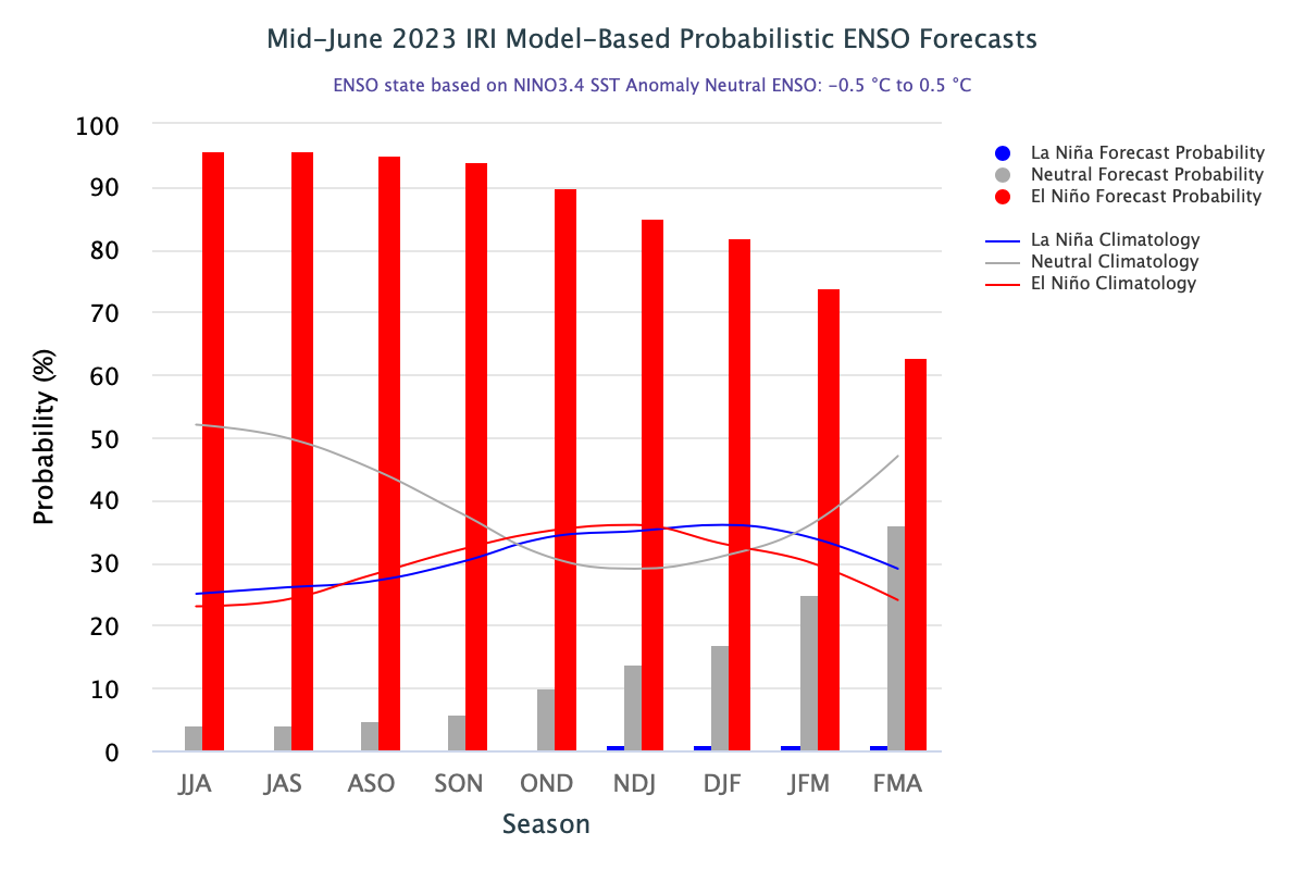
Warming of the equatorial eastern Pacific Ocean has strengthened further. Sea surface temperatures (SSTs) have warmed to El Nino thresholds. Atmospheric response, though a bit slow, but still promising for an El Nino event. There is consensus amongst most numerical models of a steep rise of the ONI (Oceanic Nino Index) through the monsoon months. El Nino will peak around the fall of the year.
ENSO: Surface warming of the equatorial Pacific Ocean can not be read in isolation. This needs to be viewed in conjunction with other climate influences. All the weekly Nino indices are above the threshold value of +0.5°C and the ONI (NINO 3.4) has reached the staging mark of 1°C. Nino 1+2 has become searing hot with temperatures nearly 3°C above the average. Such explosive warming was last observed in monsoon 2015, a drought year when Nino 1+2 remained consistently between 2.5°C and 3°C.
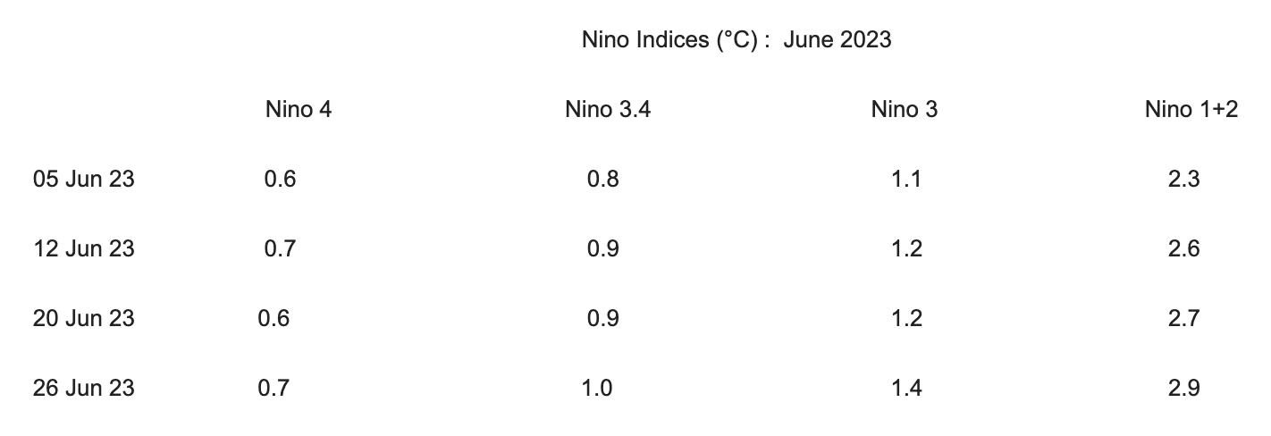
Eastern parts of the Nino region hosting Nino 1+2 and Nino 3 are significantly warmer than the western ones. Though, a bit early to say, the the pattern resembles with ‘Canonic’ El Nino. Sub-surface temperature anomalies remained positive and depicted contrasting heat potential in the thermocline.
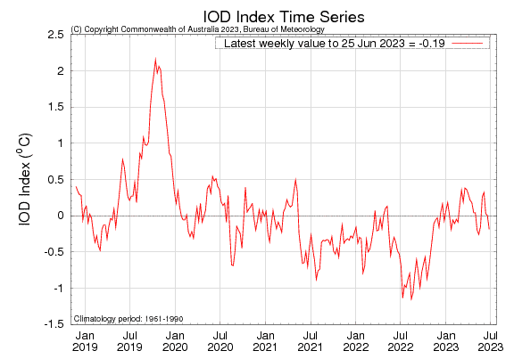
IOD: The Indian Ocean Dipole is currently negative neutral. The IOD index value for the week ending 25th June was -0.19°C. The IOD has 3 phases: neutral, +ve and -ve. Event usually starts around May/June, peak between August and October and then rapidly decay towards the fall of the year. The intensity of the IOD is represented by anomalous SST gradient between the western equatorial Indian Ocean ( 50°E-70°E and 10°S- 10°N) and the southeastern equatorial Indian Ocean (90°E-110°E and 10°S-0°). This gradient is termed as Dipole Mode Index (DMI). The IOD pattern has remained highly inconsistent so far. IOD index value has dropped to -0.19°C from its mark of +0.32°C on 05 June 2023. This is the lowest 6 weeks value and turned negative after 5 consecutive runs of +ve values.

MJO: Madden Julian Oscillation remained weak during the last week with an incoherent pattern. MJO is likely to remain over the Indian Ocean, albeit with marginal amplitude. There is no model consensus on the intensity and spread of weather activity on account of MJO during 1st and 2nd week of July. Developing El Nino seems to be a more dominant driver than the migratory pulse of MJO across the Indian seas. As per Climate Prediction Center, though enhanced convection is favoured for the North Indian Ocean but the South Asian monsoon is expected to remain relatively weak, particularly during the week of 12th-18th July 2023.

As the average warming in Nino 3.4 region is expected to rise, the confidence in the occurrence of El Nino has increased. Both, the equatorial Southern Oscillation Index (SOI) and traditional SOI have turned significantly negative. Also, the coupled ocean-atmosphere system is getting aligned to validate the emergence of strong El Nino.
