
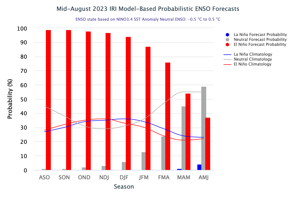
El Nino is a climate pattern which occurs because of warming of ocean waters in the central and eastern Pacific. It is the largest fluctuation disrupting weather conditions over many parts of the world. Strong El Nino is referred to the event when the sea surface temperature anomalies rise above 1.5°C. Global meteorological conditions may become chaotic in some parts when it breaches this threshold, as it happened in 2015 when it exceeded 2°C. The strength of this El Nino was among the top 3 of the last 60 years. These unusually warm waters influenced the world weather in a number of ways. These included drought conditions in Indian sub-continent, Venezuela, Australia and number of Pacific Islands, while significant flooding was recorded in some other parts. During the event, more tropical cyclones than normal occurred within the Pacific Ocean while fewer than normal formed in the Atlantic Ocean.
ENSO: In addition to the increase in the sea surface temperature anomalies, specific location of these warm pockets hold the key for its impact on different parts of the globe. Currently, the eastern half of the Nino region is more warmer than the western one. It is similar to ‘Canonic’ El Nino conditions which had appeared earlier in 2015, as well.
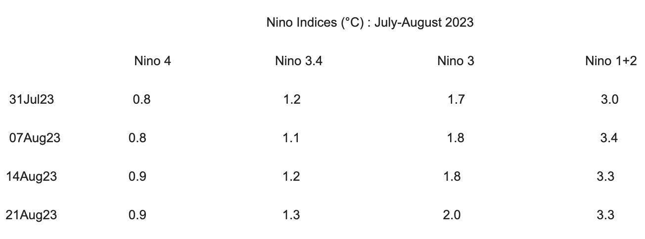
Pervasive warming in the complete Nino region has strengthened. The equatorial Southern Oscillation Index (SOI) and the traditional SOI were both negative. The atmosphere has responded reasonably well and the tropical atmosphere anomalies are consistent with El Nino.
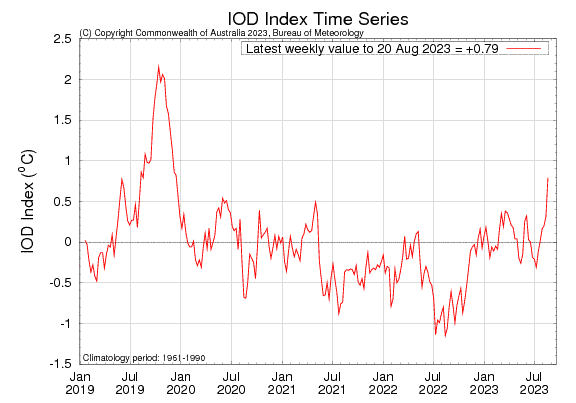
IOD: The Indian Ocean Dipole is currently positive, The IOD index for the week ending 20 Aug 2023 was +0.79°C, which is above the threshold value of +0.4°C. For the first time in this year, the index has turned positive and also rose sharply from its previous value of +0.32°C. The positive IOD index had last appeared in 2019. Subsequently, neutral conditions prevailed in 2020 & 2021, followed by negative IOD in 2022. An adequately strong positive IOD can neutralize the ill effects of El Nino. The IOD event usually start around May/ June, peak between August and October and then dissipate by the fall of year.
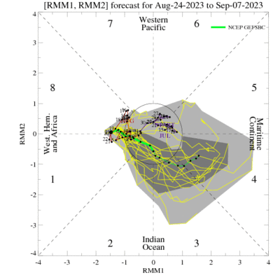
MJO: Madden Julian Oscillation is in the Western Hemisphere and currently weak. Models indicate low confidence about its track and intensity over the next 2 weeks. Though, majority of models forecast the MJO to remain weak, some expect moderately strong MJO pulse over the Pacific Ocean in the coming week and later shift over the Indian Ocean but with a trimmed amplitude. Such a development could assist enhancing El Nino conditions, a notch closer to the ‘strong’ El Nino. The West Pacific and the South China Sea are expected to have several tropical storms/ typhoons develop from the end of August, through early September. Indian seas may not find any strong monsoon system during this period.
El Nino has been pronounced as ‘slam dunk’ to persist through fall of year and Northern Hemisphere winter. El Nino impact has corrupted the monsoon rainfall in August. There is a large deficiency, in excess of 30% and is likely to grow further in the closing days of the month. Seasonal rainfall is at below normal with shortfall of 7% in the Long Period Average (LPA). With continuation of El Nino, the monsoon rainfall may not be safe even in September. The LPA may plunge further to breach double digit mark.
