
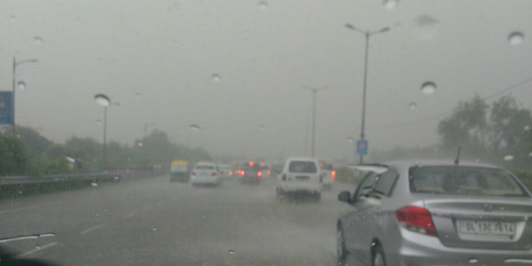
The much awaited winter rains have finally arrived for Delhi NCR. Since last 24 hours, fairly widespread rains with intense lightning and thunderstorm activities have been going on for the entire region. In fact, loud intensity of thunderstorm activities with severe lightening started way before January 21 evening onward and these activities continue over the entire region.
In the last 24 hours from 8:30 am on Monday, Safdarjung observatory has recorded 14.8 mm of rainfall while observatory at Palam has recorded 23 mm of rainfall during the same time frame.
Monthly average is 19.3 mm for the Safdarjung observatory while it is 18.4 mm at the Palam observatory. Earlier, rains had occurred over Delhi NCR on January 6, but the intensity was not too high as compared to the ongoing rains. In fact, Palam recorded only 1 mm while Safdarjung observatory recorded only 6 mm of rainfall during that time. In fact, so far, winter rains that have been recorded over Delhi NCR is 20.8 mm for Safdarjung observatory and 24 mm for Palam. Looking at the figures, it is clear that rains have exceeded monthly average figures.
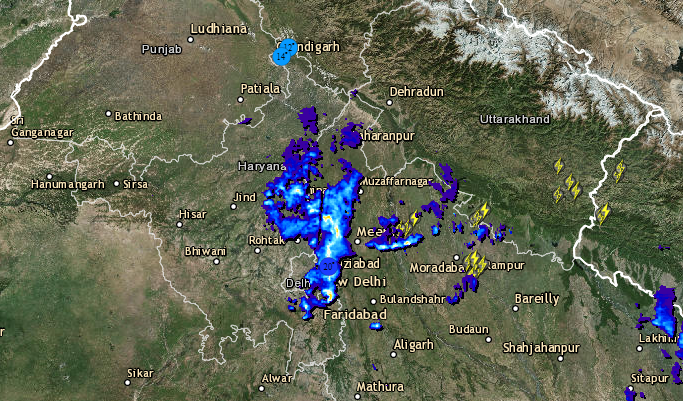
Have a look at the latest radar image for live lightning and thunderstorm status over Delhi NCR-
The month of January hardly observes any rains for Delhi and adjoining areas of Noida, Gurugram, Ghaziabad, Faridabad but the ongoing rains have proven the statement wrong. In fact, we can say that these rains are the first good winter spell for the region. Moreover, these rains could be tagged as ‘heavy’ in terms of intensity that is usually observed during winters.
Further, these rains have proven both a boon and curse for the entire region. On one hand, these have resulted in water logging at some places while on the other, these have resulted in clearing the thick layer of pollution. In fact, PM 2.5 and PM 10, both have shown a major improvement in pollution level. Thus, pollution which was earlier under ‘severe to very poor category’ has come down under ‘poor’ category. Moreover, in the presence of these rains, visibility has also improved.
Further, in view of these activities, minimums have reached 13 ℃ i.e. two or three degree below normal mark as compared to last few days. However, we expect day maximums to drop, but in any case, these may not exceed the 20 degree mark. Now, as the day progresses, we expect conditions to improve and there are no chances cold day conditions until next spell.
As per Skymet Weather, a clearance in the weather is expected till afternoon hours. However, at present chances of final clearance have been completely ruled out and we expect clouding and rains to start again today evening or night onward and continue until tomorrow morning.
Image Credit: ndtv
Please Note: Any information picked from here must be attributed to skymetweather.com
