
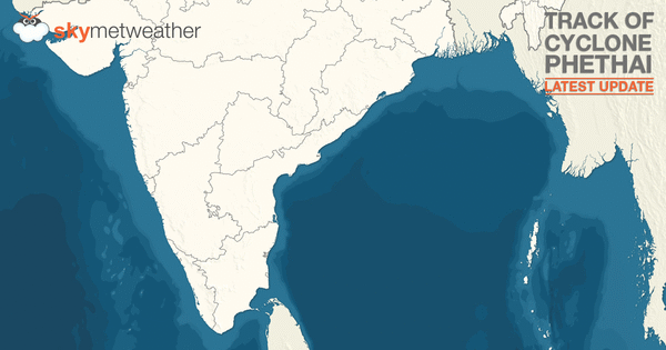
Updated on December 18, 2018 03:00 PM: Phethai weakens into a low, to become insignificant soon
Cyclone Phethai after weakening into a well marked low pressure area today morning has shown further weakening and become a low pressure area now. The system is currently over Northwest Bay of Bengal and adjoining Odisha.
Due to the cloud mass and divergence field moving towards Northeast, the system likely to weaken further. Rains however, will continue over Assam & Meghalaya and Nagaland, Manipur, Mizoram & Tripura during next 24 hours and decrease significantly thereafter.
Updated on December 18, 2018 08:30 AM: Phethai now a well marked low near Odisha, to weaken into low pressure soon
Phethai which was seen as Depression over west-central Bay of Bengal has weakened further into a well marked low pressure area over northwest and adjoining west-central Bay of Bengal and adjoining Odisha.
Due to the further inland travel, it is likely to weaken further into a low pressure area by Tuesday evening.
Updated on December 17, 2018 09:30 PM: Cyclone Phethai weakens into deep depression, to become depression shortly
As expected, Cyclone Phethai has now weakened into a Deep Depression over west-central Bay of Bengal. It is presently centered around Latitude 16.9°N and Longitude 82.4°E, still close to Kakinada.
With its further inland travel, it is most likely to shortly weaken into a Depression by late night today and further into a well marked low pressure area during the wee hours of Tuesday morning.
Updated on December 17, 2018 12:30 AM: Cyclone Phethai makes landfall over Andhra Coast, heavy to very heavy rains likely
Moving northwards, Cyclone Phethai has finally made landfall over Andhra Pradesh coast, between Kakinada and Narsapur. Along with this, squally winds to the tune of 70 kmph to 90 kmph have been blowing all along the coast.
Heavy to very heavy rains along with few spells of extremely heavy rains can be expected over parts of Andhra Pradesh during the next 12 hours.
As the system would now travel inland, we expect Phethai to soon weaken into a deep depression. Also, by evening, it is soon likely to re-curve in northeast direction and move along the coast of Odisha and West Bengal.
Updated on December 17, 2018 12:30 AM: Cyclone Phethai just 80 km away from Andhra Coast, to make landfall around 2:30 pm
Cyclone Phethai has now come very closer to the coast, which is now centered at Latitude 16.2°N and Longitude 82.2°E, around 82 km east-southeast of Kakinada, Andhra Pradesh.
High velocity winds to the tune of 80-90 kmph gusting up to 100 kmph are presently seen blowing all along the Andhra Pradesh coast. Since it is moving at a fast pace, Phethai is very likely to make landfall near Kakinada shortly, around 2:30 pm.
At the time of crossing the coast, we can expect slight fall in the wind speed, which would then flow at a speed of 70-80 kmph gusting up to 90 kmph. Heavy to very heavy rains have already commenced over the coastal parts of the state, particularly Kakinada, East Godavari, Visakhapatnam, Vijaywada and Narsapur.
Updated on December 17, 2018 11:30 AM: Phethai weakens into cyclonic storm, to hit Andhra Coast near Kakinada by afternoon
Severe Cyclone Phethai has moved further north in the last few hours at the speed of 15 kmph and has now reached quite near Andhra Pradesh coast. Phethai is presently centered near Latitude 15.5°N and Longitude 82°E, around 100 km east-southeast of Machlipatnam, Andhra Pradesh and 120 km east-southeast of Kakinada, Andhra Pradesh.
 As expected, the system has started weakening and can now be seen a cyclonic storm only. Reiterating again, this was on account of cold sea surface temperatures, strong wind shear and proximity to land mass which has resulted in entrainment.
Phethai is very likely to make landfall today afternoon as a cyclonic storm only.
Squally winds to the tune of 60 kmph to 80 kmph are already reaching to the coastal parts of Andhra Pradesh. Winds are likely to pick up pace and just before the landfall, winds would reach to 80-90 kmph gusting up to 100 kmph.
Updated on December 17, 2018: Severe Cyclone Phethai to hit Andhra Coast near Kakinada; heavy rains likely
Yesterday Cyclonic Storm Phethai has intensified into a severe Cyclonic Storm and lay centered at 2330 hrs IST of 16th December, near latitude 14.0˚N and longitude 82.5˚E, about 280 km southeast of Machilipatnam and 330 km south-southeast of Kakinada.
This system is likely to further move in north/northwest direction and cross Andhra Pradesh Coast near Kakinada during the afternoon hours on December 17.
However, this system is expected to weaken before making its landfall and cross the coast as a Cyclonic Storm with a wind of about 70 to 90 kmph gusting up to 100 kmph.
In wake of this system, we expect heavy rains to occur over coastal stations of Andhra Pradesh and Odisha.
Updated on December 16, 2018: Phethai becomes Severe Cyclone, to hit Andhra coast near Kakinada on December 17
As expected, Cyclone Phethai got more marked and intensified into a severe cyclonic storm on Sunday evening.
Phethai is now centered near Latitude 13.3°N and Longitude 83.0°E, around 300 km eastnortheast of Chennai, Tamil Nadu and 380 km southsoutheast of Machlipatnam, Andhra Pradesh and 410 km southsoutheast of Kakinada, Andhra Pradesh.
It would continue to track northnorthwestwards, inching closer to Andhra Pradesh. The system is likely to make landfall over Andhra Pradesh coast around Kakinada by the noon hours of December 17.
But as the system nears the coast, it would encounter with unfavourable conditions, like colder sea surface temperatures and strong vertical wind shear. Thus, it would weaken into a cyclonic storm before landfall.
The peripherals of the systems are already reaching the coast. As a result, intense clouding could be seen along the coastal parts of Tamil Nadu and Andhra Pradesh. Squally winds can be already seen blowing along the coastal areas.
At the time of landfall, coastal areas are likely to battle damage potential winds to the tune of 8090 kmph gusting up to 100 km.
around 300 km of Chennai and 400 km south-southeast of Machilipatnam.
Updated on December 16, 2018: Cyclone Phethai to hit Andhra on December 17, heavy rains in Andhra, Tamil Nadu ahead
The Cyclonic Strom Phethai over Southwest Bay of Bengal continues to sustain its strength while moving in north-northwest direction.
It is centered around latitude 11.3°N and longitude 84.4°E, about 465 km east-northeast of Trincomalee, Sri Lanka, 480 km east-southeast of Chennai, Tamil Nadu, 640 km south-southeast of Machilipatnam, Andhra Pradesh and 670 km south-southeast Kakinada, Andhra Pradesh.
Reiterating again, the system would continue to track north-northwestwards and make landfall cross Andhra Pradesh coast somewhere between Machilipatnam and Kakinada by the noon hours of December 17.
Atmospheric conditions are indicating that it might intensify further into a Severe Cyclonic Storm in the next 24 hours, but it would be for a shorter duration. As the system would encounter with unfavourable conditions, like lowering sea surface temperatures and strong vertical wind shear, it would weaken before landfall.
With system nearing, heavy to very heavy rains are likely to commence along the East Coast soon now. Heavy to very heavy rains likely along the Coastal Andhra Pradesh for the next two days, while moderate to heavy showers are likely over North Coastal Tamil Nadu.
Updated on December 15, 2018: Cyclone Phethai forms in Bay of Bengal, to hit Andhra Pradesh coast by Dec 17
After sustaining strength of a deep depression for over 24 hours, the system has finally intensified into a tropical storm 'Phethai'.
It is the seventh system in the row to form in Indian seas, this year.
Phethai is marked around 600 km away from Chennai. The system would continue to move north-northwest direction and chances are there that it might get more marked during the next 24 hours.
Slowly and steadily, the cyclonic storm would be heading towards Andhra Pradesh coast. It is likely to make landfall somewhere between the coast of Ongole and Kakinada by the noon hours of December 17.
With system nearing the coast, we can expect heavy to very heavy rains all along the Coastal Andhra Pradesh on December 16 and 17. In fact, extremely heavy rains are also likely over few parts of Coastal Andhra Pradesh on December 17.
Adjoining areas of North Coastal Tamil Nadu is also likely to record moderate to heavy rains on December 16. Isolated pockets of Odisha and South Chhattisgarh are also likely to record heavy rains during this time.
Rainfall would also be accompanied with squally winds. While high velocity winds of 45 kmph to 65 kmph would begin December 15 onwards along Tamil Nadu and Andhra Pradesh coast, winds would pick up pace just before the landfall and we can expect winds to the tune 80-90 kmph gusting upto 110 kmph along Andhra coast around December 17.
Sea conditions are also rough to very rough off and along the coast and locals and fishermen are not advised to venture in deep sea waters for the next 2-3 days.
Updated on December 15, 2018: Cyclone 'Phethai' likely to cross the coast somewhere between Ongole and Kakinada by late afternoon of December 17
The deep depression in Bay of Bengal has rather moved slowly northwestwards and has only covered 150 kms in 24 hours. It is still 700 kms away from east-southeast Chennai. It is centered around 9.2°N and 85.2°E. The system is in favorable waters in terms of Sea Surface Temperatures (SSTs) and is showing promising signs of becoming a cyclone by today evening. In subsequent 12-18 hours, it will intensify into a severe cyclonic storm. After becoming a cyclone, it will move north-northwest wards. Cloud configuration has already turned acquiring stormy features with circular cloud mass and having significant cloud bands on northeast and west of the system, showing signs of severe intensification.
As per the timeline, the probable cyclone is likely to cross the coast somewhere between Ongole and Kakinada by the late afternoon of December 17. As per the experts, the coastline of North Tamil Nadu and South Andhra Pradesh is going to be lashed with strong squally gusty winds from December 16 onward accompanied with heavy to very heavy rains much before the landfall, I.e. on December 16 itself.
Updated on December 14, 2018: Deep Depression in Bay to intensify into Cyclone tonight, to hit Andhra coast by Dec 17
Picking up pace, the depression in Bay of Bengal has now intensified into a deep depression over southeast Bay of Bengal. Tracking north-northwestwards, it is presently centered near Latitude 8.5°N and Longitude 87.4°E, around 670 km east of Trincomalee, Sri Lanka, 930 km eastsoutheast of Chennai, Tamil Nadu and 1090 km southeast of Machlipatnam, Andhra Pradesh.
It is very likely to intensify further into a tropical storm by tonight. Chances are also there that it might become a Severe Cyclonic Storm in subsequent 48 hours but it would be for a very short duration. The cyclonic storm would be seventh in the row this year and would be named as Phethai.
The system would continue to move in northnorthwest direction and would be heading towards Andhra Pradesh Coast. The probable cyclone is likely to cross the coast somewhere between Ongole and Kakinada by the afternoon of December 17.
As of now, the system is still away from the coast to give any weather over the coastal areas. However, by December 15, light rains would start making appearance all along the North Coastal Tamil Nadu and South Coastal Andhra Pradesh.
As the system nears, rains would also start picking up pace and we can expect heavy to very heavy rains over South Coastal Andhra Pradesh. North Coastal Tamil Nadu would see moderate rains with some heavy showers.
Sea conditions would be rough to very rough, along with high velocity winds. We can expect winds of 80 kmph -90 kmph gusting up to 110-120 kmph at the time of landfall. Locals and fishermen are advised not to venture out in the sea for the next three days.
Updated on December 13, 2018: Depression forms in Bay; Chennai, Tamil Nadu, Andhra gear for heavy rains on weekend
The well-marked low-pressure area over Southeast Bay of Bengal has moved northwestwards and intensified into a depression. At present, it is centered near Latitude 6.5°N and Longitude 88.7°E about 1170 km southeast of Chennai and 1350 km south/southeast of Machilipatnam.
The depression continues to move conducive weather conditions and is likely to intensify further into a deep-depression by Thursday evening. Weather models are indicating that it would form into a tropical cyclone during the subsequent 24 hours or we can say by Friday. If this happens, it would be seventh cyclone of this season.
Currently, this system is centered far off the coast. Therefore, during the next 24 hours, no major weather activity is expected to occur along the India coastline.
However, December 14 onwards, we expect rains to commence over Coastal Tamil Nadu and adjoining Coastal Andhra Pradesh. Rains would pick up pace by December 15 and some heavy to very heavy rains across the coastline, particularly over Chennai and Puducherry.
Updated on December 12, 2018: Depression shortly in Bay, may become cyclone; Chennai, TN, Andhra gear up for heavy rains
As expected, the low pressure area in Bay of Bengal has now intensified into a well-marked low pressure area and is now seen over Central Bay of Bengal.
Conditions continue to be favourable for the system to induce a depression in the next 24 hours. In fact, we expect it to strengthen into deep depression and further into a cyclonic circulation in the subsequent 48 to 72 hours. However, if formed, the cyclonic storm would not sustain for very long period.
The system has already given widespread rainfall over Andaman and Nicobar Islands. The sea conditions have become rough to very rough and fishermen are advised not to venture out in deep sea waters.
At present, the system is far away from the India mainland for giving any rains. For now, rains would be confined to Andaman and Nicobar Islands which might see moderate to heavy rains for the next 24 hours.
The system is likely to reach near the coast around December 14 and by December 15, we can expect some heavy rains all along the Tamil Nadu coast, particularly northern parts along with southern coastal areas of Andhra Pradesh. Chennai and Puducherry would also see heavy rains during this time.
For more read here: Heavy Chennai rains this weekend as depression likely in Bay of Bengal
Updated on December 11, 2018: Depression shortly in Bay, seventh cyclone of the year likely
The low pressure area over Equatorial Indian Ocean and Central Bay of Bengal has become more marked. As per the weathermen at Skymet Weather, we can now expect the system to induce a depression most likely in another 24 hours.
However, the system is travelling in lower latitudes, which slows down the intensification of the system. But we need not worry as the other factors needed for intensification are in place. The system is moving in a favourable zone for gaining more strength where heat potential is sufficient, with sea surface temperatures (SST) in the range of 29°C to 31°C and wind shear is also moderate.
Besides this, Madden–Julian Oscillation (MJO) which is linked with good rains over the Indian region when in close proximity is also in Indian Ocean. It is presently in phase 3 with fair amount of amplitude and is likely to stay put there till December 16. Thereafter, even when MJO shifts to phase 4 between December 17 and 20, it would continue to be in favourable zone.
Thus, with all the above factors present, we expect present low pressure to induce a depression, then a deep depression and finally a feeble cyclonic storm. If this happens, it would be seventh cyclone of the year.
Moving in west direction, the expected depression would be heading Tamil Nadu and Andhra Pradesh coast. By December 14, the system would start impacting the weather over the coast and rain would commence all along Coastal Tamil Nadu.
Rains are likely to peak around December 15-16, which might see some heavy to very heavy rains over Chennai by weekend. Gradually other parts of the state would also start receiving rains as the system travels inside the coast.
Updated on December 10, 2018: Low pressure forms in Bay of Bengal, to intensify into Depression shortly
As predicted by Skymet Weather, a low pressure area had formed in Bay of Bengal on Saturday. The system is presently seen over Equatorial Indian Ocean and Central Bay of Bengal.
Weather conditions are conducive for the system to become more marked. It is most likely to induce a depression in the next 24 to 48 hours. However, whether the system would intensify further, we will have to wait and watch.
Weather models are indicating that the system would continue to move in west direction. As of now, the weather activity under the influence if this low pressure area would be confined to sea only.
Updated on December 9, 2018: Fresh Depression likely in Bay of Bengal this week
After a keeping quiet for brief period, Equatorial Indian Ocean has once again become active. As a result, we could now see scores of weather systems penetrating in Bay of Bengal. Latest example was the system that had given good rainfall over Tamil Nadu and some heavy rains in Coastal Andhra Pradesh in the last couple of days.
At present also, a cyclonic circulation is seen over Southwest Bay of Bengal off the Sri Lanka coast.
Not only this, there is another system brewing in Southeast Bay of the Bengal in close proximity of Equatorial Indian Ocean, which is likely to make an appearance around December 9. This system seems to be a promising one and would revive Northeast Monsoon once again.
Weather models are indicating that the system would be travelling in favourable conditions of warm sea surface temperatures and low vertical wind shear. There are fair chance of system first inducing a low pressure area and thereafter a depression.
According to weathermen, system would be travelling from east to west direction towards Tamil Nadu and Andhra Pradesh coast. We expect, the system would be near the coast around December 13-14. Till then, rainfall would be confined to sea. As it nears the coast, we would see rains picking up pace along the coastline.
However, there is a week’s time in between and thus, there are fair chances of the system either hitting the coast or it might just skirt the coast. Chances of system fizzling out before reaching the coast also cannot be ruled out.
Image Credit: You tube
Any information taken from here should be credited to skymetweather.com
