
Nor'wester or the Kalbaishakhi or Bordoisila are the severe thunderstorms that occur in East India and Bangladesh, often with violent hurricane - speed winds. Some of these are embedded with ' tornadoes' or the twisters as we call it, packed with swirling winds moving forward with tremendous speed and scary roaring noise. The summery heat blows the trigger and then comes the gale speed wind with torrential rain often with hail. The complete life cycle of a Nor'wester may last for about an hour but the trail of devastation in terms of uprooting trees, blowing rooftops, flattening mud build houses, etc is a scary tale.
Kalbaishakhis occur with the increasing frequency, from March till the arrival of Monsoon over these parts. Invariably, these originate over the Chota Nagpur area and travel from west to east across West Bengal, Odisha, and Bangladesh. More often these storms strike a little before or just after sunset. There are a few salient features and important aspects worth knowing about these dangerous storms.
Development
These thunderclouds generally develop over Chota Nagpur Plateau in the afternoon hours. The Chota Nagpur Plateau is high ground with an elevation of around 4000 feet. It covers much of Jharkhand state and adjacent parts of Odisha, West Bengal, and Chhattisgarh. The development is rather fast in the form of towering tall clouds with silver line edges.
Appearance
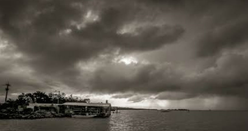
The tall cloud soon starts spreading moving southeastward. Within a short span, these turn in to dark black clouds, start thundering with bright flashes within the cloud.
Track
The storm moves from west to east to batter Gangetic West Bengal and North Odisha. They move with tremendous speed, giving very little notice to evade its ferocity and adopt safety measures. Nor'westers are characterized by deafening thunder, howling winds and scary lightning with heavy rains.
Regeneration
The towering thunderstorm cells have a tendency to regenerate another cell ahead of it. The old cells dissipate and the fresh one keeps coming up. This process continues and the cloud pattern may take shape of a 'squall line'.
The meteorological conditions are favorable for a prolonged spell of intense weather over Eastern parts and particularly over West Bengal and in that too the capital city Kolkata. A cyclonic circulation is marked over East Madhya Pradesh and north Chhattisgarh and moist winds from the Bay of Bengal are resulting confluence over eastern parts. Such conditions are conducive for widespread thundersqualls and Nor'westers lashing the region for the next few days. This activity could be more intense today and then between 24th to 28th April. Few locations seem more vulnerable like Midnapore, Panagarh. Burdwan, Digha, Diamond Harbour, Kolkata, and Howrah.
