
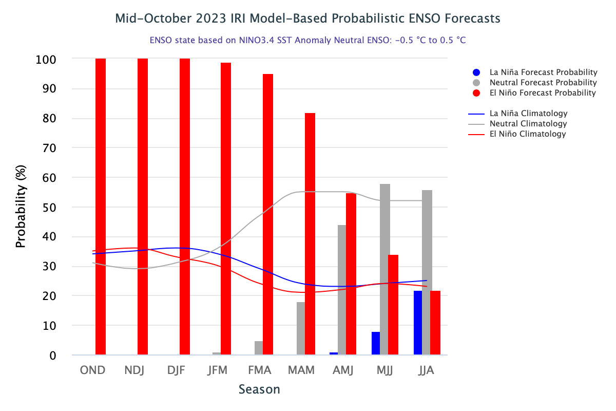
Model-based probabilistic ENSO forecast is extending right up to Monsoon 2024. However, it is rather early to preempt any inference and offer comments about the next southwest monsoon season. However, there is conclusive evidence that El Nino is going to wither during the winters of the Northern Hemisphere. All three components of ENSO: El Nino, Neutral, and La Nina will get manifested with some floating configuration to start with. It will take time for the entire pattern to get stabilized and possibly Jan-Feb projection may be reliable enough to read the next season.
ENSO: Climatologically, the sea surface temperature anomalies have reversed from January 2023 to October 2023, in the equatorial Pacific Ocean. Starting in Feb 2023, with the cessation of La Nina, SSTs transitioned from below-average to above-average. During the monsoon months, the positive anomalies expanded westward from the eastern Pacific Ocean. However, the positive anomalies have weakened slightly in the eastern Pacific Ocean. Of late, SST anomalies have increased near the International Date Line.
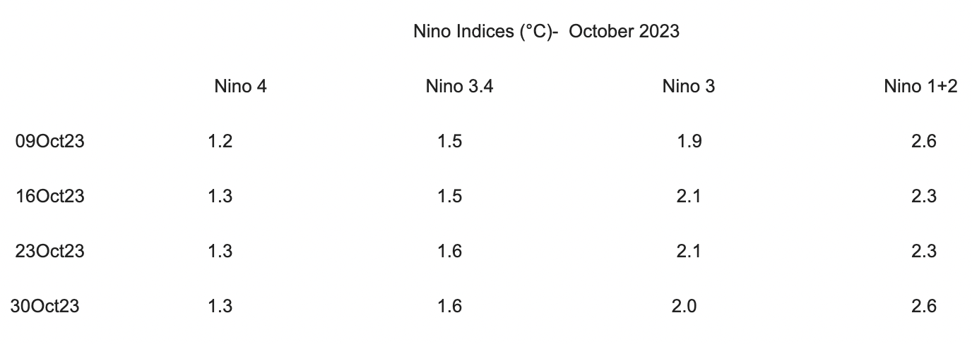
The entire Nino region remains well above the threshold mark of +0.5°C. Nino 3.4 seems to be plateauing around 1.6°C. It has been hovering around this value for the last about 10 weeks.
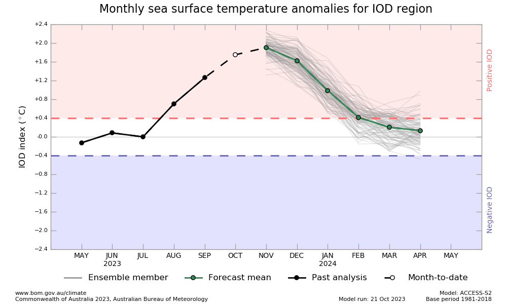
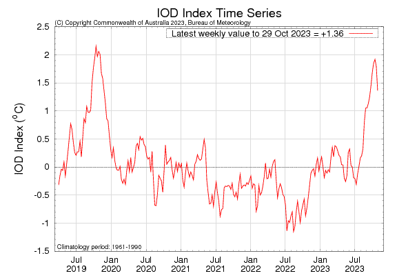
IOD: The Indian Ocean Dipole index for the week ending 29 Oct 2023 was +1.36°C. There is a significant drop from its earlier mark of 1.92°C on 16 Oct 2023 and 1.79°C on 23 Oct 2023. The index value has started dropping a bit earlier than the model projection of post-Nov 2023. But then, this much of error is quite understandable and falls within the permissible limits.
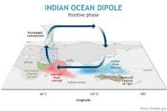
IOD event usually starts around May, peak between Aug and Oct and then rapidly decay during the fall of the year. As such, the dipole pattern is unable to persist once the Inter Tropical Convergence Zone (ITCZ) shifts to the Southern Hemisphere. Strong positive IOD during the later half of the southwest monsoon was responsible for late retreat from northern and eastern parts. It has a cascading effect resulting delay in shifting the monsoon trough to the southern hemisphere.
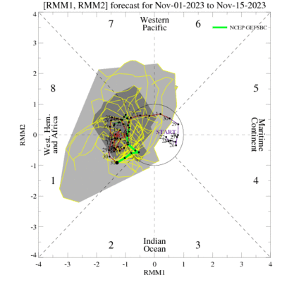
MJO: Madden-Julian Oscillation is a lesser-known entity as compared to ENSO and IOD. However, it can trigger some extreme events. Unlike ENSO & IOD, which are stationary patterns, MJO is an eastward moving pulse of clouds, rainfall, winds and pressure, that traverses in the tropics with a cycle of 30-60 days. So, there can be multiple MJO events within a season. It is the largest phenomenon causing intra-seasonal tropical climate variability.
The MJO is currently weak. There are competing influences of ongoing El Nino, as well as active IOD. Dynamical model outcomes differ and therefore good deal of uncertainty on its positioning and amplitude. Broadly, it is going to remain in the Western Hemisphere with varying amplitude.
At longer leads, the skill of the models degrades. The variability of the set of initial conditions and the physics parameterization coupled with uncertainties of skills may impact model estimates. Therefore, caution is advised to cater for the errors in interpreting and utilization of forecast distributions. Human judgements in combination with the model guidance offer the best bet.
