
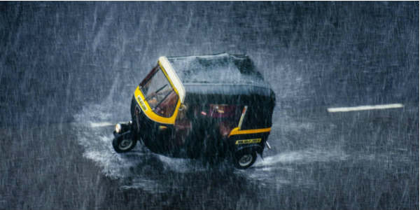
After the late arrival of Southwest Monsoon, several parts of Uttar Pradesh, particularly eastern districts recorded some very good showers; while in the meanwhile, rains remained few over the western regions.
In a span of 24 hours from 08:30 am on Wednesday, Bahraich recorded 67 mm of rainfall, followed by Gorakhpur 66 mm, Fursatganj 58 mm, Najibabad 47 mm, Hardoi 45 mm, Lucknow 36 mm, Bareilly 10 mm and Meerut 7 mm of showers.
[yuzo_related]
As per Skymet Weather, these weather conditions can be credited to a cyclonic circulation over East Uttar Pradesh. Also, a trough is extending from North Punjab to East India across Uttar Pradesh, Bihar and further toward Gangetic West Bengal.
Owing to this, weathermen expect moderate to heavy rains to continue over central and eastern parts of the state during the next 24 hours. Isolated rains may also occur over the western regions. The rain intensity is likely to be much more over northern parts of Uttar Pradesh, particularly the foothills.
Light to moderate rain and thundershower may occur over some parts of Bareilly, Hardoi, Lakhimpur Kheri, Moradabad, Pilibhit, Rampur, Shahjahanpur, Sitapur, Bhabua, Singrauli, Allahabad, Ambedkar Nagar, Amethi, Azamgarh, Ballia, Balrampur, Banda, Bara Banki, Basti, Chandauli, Chitrakoot, Deoria, Faizabad, Fatehpur, Ghazipur, Gonda, Gorakhpur, Jaunpur, Kaushambi, Lucknow, Mau, Mirzapur, Pratapgarh, Rae Bareli, Sant Kabir Nagar, Sant Ravi Das Nagar, Siddharth Nagar, Sonbhadra, Sultanpur, Unnao and Varanasi during the next 6 to 12 hours.
Take a look at the live lightning and thunderstorm status across Uttar Pradesh
Yesterday, West Uttar Pradesh was rain surplus by 27%, while East Uttar Pradesh was rain deficit by 28%. Currently, the situation has taken an opposite turn; West Uttar Pradesh is rain surplus by 39%, while East Uttar Pradesh is rain deficit by 9%. With more rains on cards, we can hope the rain deficiency to reduce speedily in the next two days.
Thunder and lightning strikes are more during the pre-Monsoon period. The reason for this is high temperatures and intermittent increase in humidity levels that leads to convective cloud development.
On the contrary, as Monsoon reaches, temperatures start to subside, thus the formation of these clouds also reduces. The thundery clouds during pre-Monsoon are substituted by low or medium clouds during Monsoon. Therefore the intensity of rain decreases, while time span and spread increases. Thus lightning and thunderclouds are not as observable as during pre-Monsoon period.
Image Credit: abraxasnu.com
Any information taken from here should be credited to skymetweather.com
