
The month of May is the peak Pre-Monsoon period where all weather activities are at their extreme. Right from intense heat and heatwave conditions to thunderstorm, dust storm, lightning, hailstorm, squally winds and rains; all these weather activities are at their prime during this time.
Almost the entire country is affected by rain, thunderstorm, and dust storm activities barring the Gujarat as well as the extreme South Rajasthan region which are heat dominant pockets. Here, intense heatwave conditions remain at the front foot with weather being extremely uncomfortable for the region.
[yuzo_related]
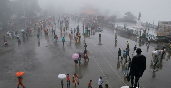
In fact, in the past 24 hours, fairly widespread weather activity in terms of rains, thunderstorm and dust storm along with lightning has been witnessed over many parts of the country. Major cities of Delhi, Kolkata, Bengaluru, Hyderabad and Delhi witnessed rains simultaneously.
For the next two days, the northern parts of the country which includes the hills as well as the plains comprising of North Rajasthan, Punjab, Haryana, Chandigarh, Delhi and West Uttar Pradesh are expected to witness rainfall activity along with dust storm, lightning and thunderstorm.
Entire Northeast India along with East India including Bihar, Jharkhand, West Bengal, Odisha as well as Chhattisgarh will also witness some weather activities. Rains will also be seen along the East Coast including Andhra Pradesh and other southern parts of the country including Interior Telangana, Kerala, Interior Tamil Nadu, and South Karnataka.
Meanwhile, no weather activity is expected over Gujarat, West Madhya Pradesh, and Maharashtra. Slight weather activity is expected over Vidarbha.
There are multiple weather systems that are likely to cause these weather activities. The northern parts of the country will witness rains due to the Western Disturbance over the Western Himalayan region and the cyclonic circulation is over Haryana and adjoining areas.
East and Northeast India are expected to see rains due to the convergence of winds from the anti-cyclone over Bay of Bengal and the Indo Gangetic Plains along with which a cyclonic circulation over Bihar and adjoining West Bengal.
Talking about South India, the region will see rains due to the semi-permanent feature of the Pre-Monsoon season, the trough which will give western half of the southern parts of the country.
Image Credit: ndtv
Please Note: Any information picked from here must be attributed to skymetweather.com
