
Since last many days, the north Indian hills have been witnessing dry spell, though the winter conditions sustained its grip over the region. Maximum as well as minimum temperatures have marked huge variation. In fact, some areas also recorded sub-zero temperatures.
[yuzo_related]
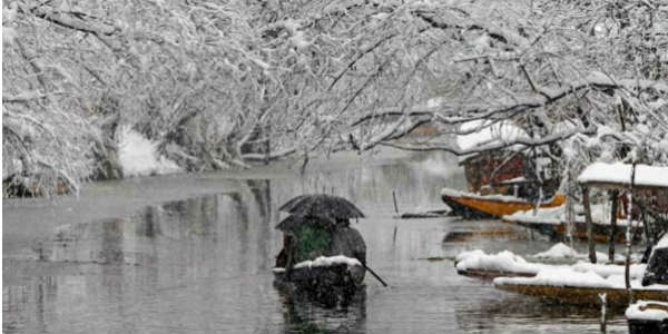
Presently, a fresh Western Disturbance is affecting Jammu and Kashmir and parts of Himachal Pradesh. With this weather system, light to moderate rain and snow are predicted at few places over Jammu and Kashmir and one or two places over Himachal Pradesh during the next 24 hours. Isolated light showers will also be seen over Vaishno Devi on January 4 and 5.
Click the image above to see the live lightning and thunderstorm across Asia
Further, we expect day temperatures to fall significantly due to rainfall and cloud cover. Contrary to this, minimum temperatures will witness an upward trend.
By January 6, this Western Disturbance is most likely to move away eastwards, paving way for dry weather to return over the northern hills, namely Jammu and Kashmir, Himachal Pradesh and Uttarakhand.
What’s more, maximum temperatures will also start mounting, but night temperatures will drop. Snowfall will occur but intensity will remain light to moderate and heavy to very heavy snow is ruled out. However, there are still likelihoods of landslides over the region. So, travelers are advised to stay aware and cautious.
Image Credit: youtube.com
Any information taken from here should be credited to skymetweather.com
