
The hills of North India have been receiving on and off pre-Monsoon activities. However, a fresh Western Disturbance has approached the Western Himalayas yesterday and has already given rain and thundershowers over Jammu and Kashmir, Himachal Pradesh and Uttarakhand. One or two districts of Himachal Pradesh received moderate to heavy spells.
[yuzo_related]
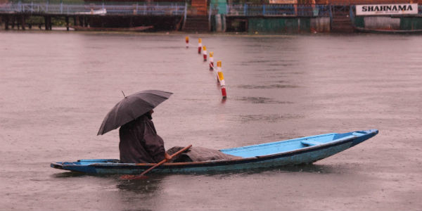
In the last 24 hours from 08:30 am on Wednesday, Banihal recorded 3.6 mm of rain, Batote 7.8 mm, Bhaderwah 3.8 mm, Gulmarg 5 mm, Katra 2.8 mm, Pahalgam 3.8 mm, Srinagar 1.9 mm, Chamba 4 mm, Dharamshala 18.8 mm, Kalpa 3.4 mm, Keylong 13 mm, Kullu 4.4 mm, Manali 18.2 mm, Nahan 17.8 mm, Shimla 5.8 mm, Almora 19 mm, Dehradun 8.3 mm, Haridwar 8 mm, Mussoire 11.3 mm, Nainital 14 mm, Pithoragarh 17.2 mm.
Further, this Western Disturbance will gradually move away eastwards, but successive Western Disturbances are expected to affect Western Himalayas in the coming days therefore, we expect on and off rain and thundershower activities to continue till May 8.
Even though there may be a slight gap between the Western Disturbances leading to decreased rainfall activity. But the weather will not go completely dry for at least next one week.
Therefore, we can say that whenever there is a prolonged spell of rain over the hills, it leads to landslide and road blocks in the hilly region.
Heatwave which was being observed over parts of Jammu and Kashmir and Himachal Pradesh, has now abated and we expect the temperatures to remain under check for at least next one week.
Image Credit: J&K news
Any information taken from here should be credited to skymetweather.com
