
 The hottest state of India, Rajasthan has been receiving pre-Monsoon activities. Since last few days, rain, thundershower and dust storm activities are continuously affecting mostly the western and northern parts of the region.
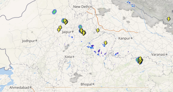
At present also, places like Dausa, Hanumangarh and Sriganganagar are also recording rain and thundershowers, along with squally winds. These pre-monsoon activities will now subside for next 24 hours.
However, these rain and thundershowers are likely to pick up pace again soon. According to Skymet Weather, we expect a significant increase in rain, thundershower and thunderstorm activities by May 20 and May 21. State capital of Jaipur is also likely to record some good rain and thundershowers.
Click here to check the live status of lightning and thunderstorm across Rajasthan
 Though these activities are highly localized. These pre-Monsoon activities normally occur during late afternoon or evening hours, which is the typical pattern of pre-Monsoon activities over Northwest India.
This increase in the weather activities would be due to the formation of a cyclonic circulation over central parts of Pakistan and adjoining Rajasthan. A trough will also be extending from this cyclonic circulation up to Southwest Uttar Pradesh.
We expect maximum temperatures to decrease over places like Bikaner, Churu, Sriganganagar and some nearby districts. Hence, temperatures are expected to remain normal for next two to three days.
The Southwest Monsoon rains normally reaches Rajasthan by the end of June.
Image credit: Udaipurblog.com
Any information taken from here should be credited to skymetweather.com
