
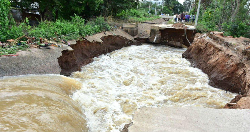
Uttarakhand, Himachal Pradesh, Jammu, and Kashmir are all set to witness another round of rain and thundershower activities starting from tomorrow. The weather activities would remain mostly confined to the lower reaches or low lying areas of all the three hilly states. Landslides and mudslides coupled with localized flooding cannot be ruled out during this rainy episode.
At present, a series of weather system is moving across the northern hills, thus making the conditions favorable for rains again. These weather systems include a Cyclonic Circulation over Central Madhya Pradesh, gradually moving towards the northern parts of Madhya Pradesh. This system would gradually shift the Monsoon Trough, thus bringing it closer to the foothills of the Himalayas. Another system that lies in the Bay of Bengal is moving in the westerly direction.
Due to all these active systems, rain and thundershower activities would again commence in Jammu and Kashmir, Himachal Pradesh and Uttarakhand tomorrow onward. The enhanced rainfall activities are likely between September 3 and 6, wherein fairly widespread rains will lash the Western Himalayas. Rains would mainly be moderate, however, some heavy spells in parts of Uttarakhand and Himachal Pradesh cannot be ruled out.
Despite some good amounts of rain, Uttarakhand, Jammu, and Kashmir, as well as Himachal Pradesh, are marginally rain deficient by 23%, 13%, and 7% respectively, as per the rainfall data available with Skymet from June 1 to September 1 (+/- 19 is normal). These deficiency figures fluctuate on a regular basis. This because all three hilly states do not receive rains at the same time.
The ever oscillating Monsoon Trough, when it comes closer to the foothills of the Himalayas, brings in significant rainfall activities for the trio states. In addition to this Trough, it is the other weather systems that pop up in the Bay of Bengal and move towards the central parts of the country, thus taking the Monsoon Trough along with them. Another major reason is the presence of the Western Disturbance across the hilly region. When there is a combination of more than one weather system, Monsoon rains aggravate.
For the foothills and the low lying areas having a height of 6000-7000 feet, it the Monsoon Trough that brings in active rains, while for the higher reaches, it is the Western Disturbance that plays a major role.
These lower reaches or low lying areas include Shimla, Kullu, Dharamshala, Jammu, Katra, Una, Nainital, Dehradun, Pantnagar, etc. All these areas would witness good Monsoon showers for the next three to four days starting from tomorrow. However, precautions must be taken as landslides, mudslides along with localized flooding cannot be ruled out here.
Image Credits – The Statesman
Any information taken from here should be credited to Skymet Weather
