Weather Forecast September 01: Heavy Rain Alert for Odisha, Assam, Chhattisgarh, Uttarakhand and East UP

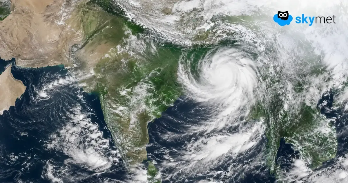
Representational Image: AI-Skymet
Key Takeaways:
- A Well-Marked Low-Pressure Area persists over Gangetic West Bengal, adjoining north coastal Odisha and the northwest Bay of Bengal.
- The system is likely to move west-northwestwards across north Odisha-Gangetic West Bengal during the next 24 hours.
- Odisha, Assam, Chhattisgarh, Uttarakhand and East Uttar Pradesh may receive light to moderate rain with a few heavy spells.
- Light to moderate rainfall is also expected across parts of East and Northeast India, Central India and the West Coast.
- Forecast Validity: Next 24 hours.
Advertisement
The Weather Systems Over The Country
Advertisement
The Well-Marked Low-Pressure Area over Gangetic West Bengal and adjoining areas of north coastal Odisha and the northwest Bay of Bengal persists over the same region. The associated cyclonic circulation extends up to 7.6 km above mean sea level. It is likely to move west-northwestwards across north Odisha-Gangetic West Bengal during the next 24 hours.
The Monsoon Trough at mean sea level continues to pass through Amritsar, Patiala, Bareilly, Sultanpur, Gaya, and the centre of the Well-Marked Low-Pressure Area over Gangetic West Bengal and adjoining areas of north coastal Odisha and the northwest Bay of Bengal, extending southeastwards up to the east-central Bay of Bengal.
A trough extending from the cyclonic circulation associated with the Well-Marked Low-Pressure Area over Gangetic West Bengal and adjoining areas of north Odisha and the northwest Bay of Bengal to East Uttar Pradesh, across Jharkhand and Bihar, persists and extends up to around 3.1 km above mean sea level.
An upper-air cyclonic circulation over Saurashtra and adjoining areas, extending up to 5.8 km above mean sea level, persists.
The Western Disturbance as a cyclonic circulation over north Pakistan and adjoining Jammu Division, extending up to 5.8 km above mean sea level, persists.
Weather Activities During The Last 24 Hours
During the last 24 hours, light to moderate rain with a few heavy spells occurred over Odisha, Assam, Chhattisgarh, Himachal Pradesh, and East Uttar Pradesh.
Light to moderate rain occurred over Northeast India, West Bengal, Sikkim, Bihar, Jharkhand, Chhattisgarh, East Madhya Pradesh, East Uttar Pradesh, Konkan and Goa, Madhya Maharashtra, Coastal Karnataka, Lakshadweep, the Andaman and Nicobar Islands, Interior Karnataka, and parts of Telangana.
Light rain occurred over Gujarat, Vidarbha, South Interior Karnataka, Kerala, Jammu and Kashmir, and Andhra Pradesh.
Forecast
During the next 24 hours, light to moderate rain with a few heavy spells may occur over Odisha, Assam, Chhattisgarh, Uttarakhand, and East Uttar Pradesh.
Light to moderate rain is possible over Northeast India, West Bengal, Sikkim, Bihar, Jharkhand, Chhattisgarh, East Madhya Pradesh, East Uttar Pradesh, Konkan and Goa, Madhya Maharashtra, Coastal Karnataka, Lakshadweep, and the Andaman and Nicobar Islands.
Advertisement
Light rain is possible over Himachal Pradesh, Gujarat, Vidarbha, Interior Karnataka, Kerala, Jammu and Kashmir, and Andhra Pradesh.
Trending: