
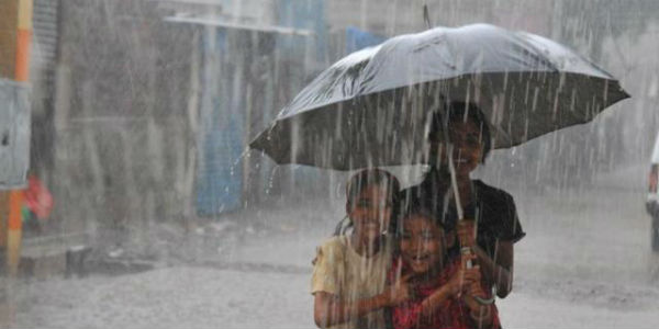
 The well marked over Northwest Bay of Bengal and adjoining West Bengal and Odisha continues to keep Monsoon 2018 active over East India. The system has already given extremely heavy rains over Odisha, while fairly widespread rains were seen across Chhattisgarh and parts of West Bengal.
The system had formed around August 25 and has remained practically stationary since then. As a result, the system has been giving widespread rains over West Bengal and Odisha. In fact, last 24 hours saw some extremely heavy rains.
In span of 24 hours from 8:30 am on Sunday, Bhawanipatna recorded 163 mm, followed by Titlagarh 134 mm, Chandbali 96 mm, Balasore 33 mm, Paradip 30 mm, Jharsuguda 21 mm and Puri 19 mm.
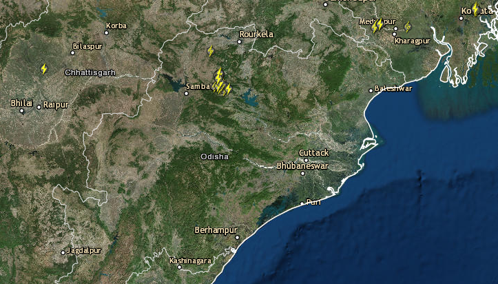 Checkout the live lightning and rainfall status across Odisha
According to Skymet Weather, the proximity of the coast would not allow the well marked low pressure are to intensify further. Besides this, weather models are showing very sluggish movement of the system in the coming days.
Thus, we can expect that this Monsoon system is going to affect the weather over central and eastern parts of the country for good number of days. During the next 24 hours, we can expect moderate to heavy rains over Odisha and Chhattisgarh.
Thereafter, the system will move in west direction, gradually vacating Odisha. Rains would then decrease over Odisha but light to moderate rains would continue.
Meanwhile, East Madhya Pradesh, Chhattisgarh and Vidarbha would too record some good rainfall. Peripheral of the system would also give rains over Marathwada region, Telangana, Uttar Pradesh and Bihar.
Subsequently as the system would start giving rains over entire Madhya Pradesh, West Uttar Pradesh along with Chhattisgarh. It may also give rain over adjoining areas of Gujarat and Rajasthan.
According to weathermen, we are now reaching at August end. Characteristics and behavior of the weather systems are all set to change. Systems now forming in Bay would not be that intense to travel all across central parts of the country to Rajasthan. This change in pattern is because Monsoon is now in the process of withdrawing itself from West Rajasthan shortly.
In addition to this, there is a cyclonic circulation over South Rajasthan and adjoining Gujarat region and a shear zone is marked between this cyclonic circulation and well marked low pressure area. This zone has made the movement of this system more sluggish. In fact, both the systems have hardly moved anywhere for the last two days.
Although the low pressure area may not travel up to Rajasthan but its sluggish movement would give prolonged weather active over central parts of the country.
Image Credit:en.wikipedia.org
Any information taken from here should be credited to skymetweather.com
