Updated on June 13, 2019 8:30 AM: Very Severe Cyclone Vayu to recurve and weaken, Gujarat coast to not be hit
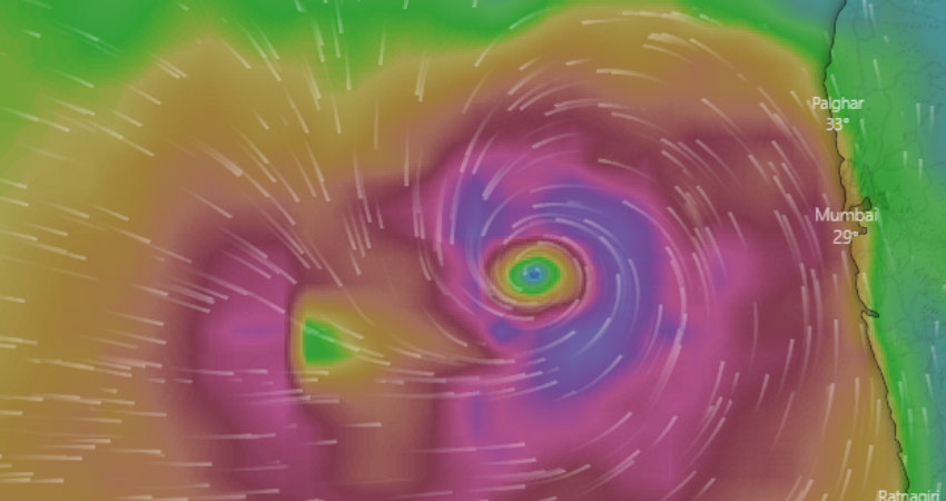
The Very SevereCyclone Vayuwhich was all set to hit Gujarat has taken a detour and will nowjust skirt the Gujarat coast, as it will recurve. There will still be heavy rains over Gujarat, but as the Cyclone will just skirt the coast, the damaging potential will not be as much. However, winds gusting up to 175 kmph may definitely pose some threat to the coast.
Cyclone Vayu will just skirt theGujarat coast near Porbandar, close to Dwarka or Okha coast and is also likely to weaken into a Cat 1 Storm. It is also possible that Vayumay just make landfall in the seaand not hit land at all.
Published on June 12, 2019: This season has seen two powerful cyclones making their presence felt on either side of the coast. First it was Cyclone Fani which throttled Odisha causing widespread damage in the state in the beginning of May.
Now, it isCyclone Vayu, which formed in the Arabian Sea which has been moving north northwestwards, becoming powerful each minute. The system has now become a Very Severe Cyclonic Storm and is heading towards the Saurashtra Coast and is likely to make landfall tomorrow morning, maintaining its intensity while it crosses the coast. Vayu is currently equivalent to a Hurricane Cat 2.
The state of Gujarat is expected to see hefty rains with strong winds and possibility of flooding in many areas as well. Moreover, the Government has started to make ample preparations in view of theCyclone Vayu, right from having NDRF teams deployed toevacuating at least 3 lakh people from Gujarat.
The unfortunate part is that it will not be possible to track Vayu live as was done during the time of Fani. Cyclones are tracked each minute by Cyclone Detection Radars (CDR) which are sufficiently available on the East Coast. Moreover, right from Chennai, Machilipatnam, Visakhapatnam, to Kolkata there are CDRs installed. Even Gopalpur and Paradip have a network of Cyclone Detection Radars.
Moreover, the East Coast provides an overlapping coverage of radars which makes it easy to track these systems each minute at the time of nearing, which was the case during the time of Fani. These radars give you nearly real time images.
The radar coverage is a little poor as compared to the East Coast, and after Mumbai, the track which Cyclone Vayu is following does not have CDRs. There is a radar at Bhuj but not only it is not a CDR but also, the crossing point will fall outside of effective range of Bhuj Radar.
Therefore, the Radar coverage ofCyclone Vayueach minute will not be possible. There will be space based platforms including satellite imageries to track Vayu, but they will have some lag, and thus may not be able to provide nearly real time images.
Image Credit: windy.ty
Please Note: Any information picked from here must be attributed to skymetweather.com