Weather update and forecast for December 19 across India


KEY TAKEAWAYS
- Two Western Disturbances are influencing North India’s winter weather.
- Dense to very dense fog continues across the Indo-Gangetic Plains.
- Snowfall and rain are likely in the western Himalayan region.
- Jet stream winds remain strong over North India.
The weather system over the country:
A Western Disturbance is seen as a cyclonic circulation over Iran and adjoining areas at 3.1 km above mean sea level.
Another Western Disturbance is seen as a cyclonic circulation over Jammu and adjoining areas at 3.1 km above mean sea level.
The sub-tropical westerly jet stream, with core winds of up to 110 knots at 12.6 km above mean sea level, is blowing over North India.
Weather Activity in the last 24 hours:
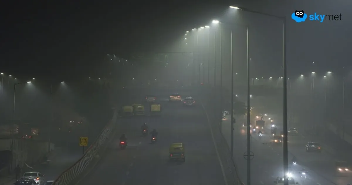
During the last 24 hours, dense to very dense fog occurred over the Indo-Gangetic Plains from Punjab, Haryana, and Delhi to Bihar, across Uttar Pradesh.
Shallow fog was observed over Uttarakhand, Assam, Meghalaya, Nagaland, Manipur, Mizoram, Tripura, and coastal Andhra Pradesh.
Light to moderate rain occurred over South Tamil Nadu, while isolated light rain was reported over South Kerala and Lakshadweep.
Forecast for the next 24 hours:
During the next 24 hours, light rain and snowfall may occur over parts of Jammu & Kashmir, Ladakh, Gilgit-Baltistan, and Muzaffarabad between December 18 and 23, and over Himachal Pradesh and Uttarakhand on December 20 and 21.
Light rain may occur in isolated pockets of Punjab on December 20 and 21, and over West Rajasthan on December 21.
Moderate to dense fog is likely over parts of Punjab, Haryana, Delhi, Uttar Pradesh, and Bihar.
Shallow fog is possible over Northeast India.
Do not miss:
Any information picked from here must be attributed to Skymet!